
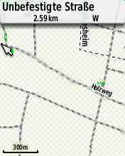
Since I have created maps for my Garmin GPS device some days ago something strange happens. The background of the map is loaded with small brownish squares (see attachment) instead of blank/white. I have not changed the style files as well as the TYP file. By the way, the same background drawing happens if no TYP file is used. Was there a change in mkgmap which causes the squares? Does anyone else have this problem? Sincerely, Thomas

Hi Thomas, do you use the --transparent option? There have been a bugfix in r2479 that transparent maps were not transparent. WanMil
Since I have created maps for my Garmin GPS device some days ago something strange happens. The background of the map is loaded with small brownish squares (see attachment) instead of blank/white. I have not changed the style files as well as the TYP file. By the way, the same background drawing happens if no TYP file is used.
Was there a change in mkgmap which causes the squares? Does anyone else have this problem?
Sincerely,
Thomas
_______________________________________________ mkgmap-dev mailing list mkgmap-dev@lists.mkgmap.org.uk http://lists.mkgmap.org.uk/mailman/listinfo/mkgmap-dev
Am 28.03.2013 15:45, schrieb WanMil:
Hi Thomas,
do you use the --transparent option?
There have been a bugfix in r2479 that transparent maps were not transparent.
WanMil
Since I have created maps for my Garmin GPS device some days ago something strange happens. The background of the map is loaded with small brownish squares (see attachment) instead of blank/white. I have not changed the style files as well as the TYP file. By the way, the same background drawing happens if no TYP file is used.
Was there a change in mkgmap which causes the squares? Does anyone else have this problem?
Sincerely,
Thomas
_______________________________________________ mkgmap-dev mailing list mkgmap-dev@lists.mkgmap.org.uk http://lists.mkgmap.org.uk/mailman/listinfo/mkgmap-dev
Hi WanMil, thank you for you help. Indeed I used the --transparent option. After removing it seems to work as expected. Thomas
Am 28.03.2013 15:45, schrieb WanMil:
Hi Thomas,
do you use the --transparent option?
There have been a bugfix in r2479 that transparent maps were not transparent.
WanMil
Since I have created maps for my Garmin GPS device some days ago something strange happens. The background of the map is loaded with small brownish squares (see attachment) instead of blank/white. I have not changed the style files as well as the TYP file. By the way, the same background drawing happens if no TYP file is used.
Was there a change in mkgmap which causes the squares? Does anyone else have this problem?
Sincerely,
Thomas
_______________________________________________ mkgmap-dev mailing list mkgmap-dev@lists.mkgmap.org.uk http://lists.mkgmap.org.uk/mailman/listinfo/mkgmap-dev
Removing the --transparent option causes that on the GPS device the polygons (woodland etc.) are no more drawn. Any suggestions? Thanks. Thomas

Maybe they are covered by the default background/land polygon, type 0x27. You can make this land polygon either transparent with a typ file, change the draw order of 0x27 as low as possible but above the sea, or use another background polygon with the generate-sea option.
Removing the --transparent option causes that on the GPS device the polygons (woodland etc.) are no more drawn. Any suggestions?
Thanks. Thomas
_______________________________________________ mkgmap-dev mailing list mkgmap-dev@lists.mkgmap.org.uk http://lists.mkgmap.org.uk/mailman/listinfo/mkgmap-dev
I have tried several options described but none works. Removing the --transparent option actually destroys all polygon formatting of the TYP file. If I could I would like to downgrade prior to r2479 but unfortunately it is no more available. Seems I have to get along with the strange brownish squares ... Thomas Am 28.03.2013 22:00, schrieb Minko:
Maybe they are covered by the default background/land polygon, type 0x27. You can make this land polygon either transparent with a typ file, change the draw order of 0x27 as low as possible but above the sea, or use another background polygon with the generate-sea option.
Removing the --transparent option causes that on the GPS device the polygons (woodland etc.) are no more drawn. Any suggestions?
Thanks. Thomas
_______________________________________________ mkgmap-dev mailing list mkgmap-dev@lists.mkgmap.org.uk http://lists.mkgmap.org.uk/mailman/listinfo/mkgmap-dev

Hi Thomas, probably something is wrong, so you let us help you to fix the error. Please try to describe what you are doing and post links to your files so that we can reproduce the problem. Ciao, Gerd Thomas Kaschel wrote
I have tried several options described but none works.
Removing the --transparent option actually destroys all polygon formatting of the TYP file. If I could I would like to downgrade prior to r2479 but unfortunately it is no more available. Seems I have to get along with the strange brownish squares ...
Thomas
Am 28.03.2013 22:00, schrieb Minko:
Maybe they are covered by the default background/land polygon, type 0x27. You can make this land polygon either transparent with a typ file, change the draw order of 0x27 as low as possible but above the sea, or use another background polygon with the generate-sea option.
Removing the --transparent option causes that on the GPS device the polygons (woodland etc.) are no more drawn. Any suggestions?
Thanks. Thomas
_______________________________________________ mkgmap-dev mailing list
mkgmap-dev@.org
_______________________________________________ mkgmap-dev mailing list
mkgmap-dev@.org
-- View this message in context: http://gis.19327.n5.nabble.com/Strange-squares-on-Garmin-GPS-device-tp575505... Sent from the Mkgmap Development mailing list archive at Nabble.com.
forgot to mention that the --transparent option just tells mkgmap not to add a background polygon with type 0x4a. So, if you see "brownish squares" whitout this option it is likely that your type file contains these squares for type 0x4a. Gerd GerdP wrote
Hi Thomas,
probably something is wrong, so you let us help you to fix the error. Please try to describe what you are doing and post links to your files so that we can reproduce the problem.
Ciao, Gerd Thomas Kaschel wrote
I have tried several options described but none works.
Removing the --transparent option actually destroys all polygon formatting of the TYP file. If I could I would like to downgrade prior to r2479 but unfortunately it is no more available. Seems I have to get along with the strange brownish squares ...
Thomas
Am 28.03.2013 22:00, schrieb Minko:
Maybe they are covered by the default background/land polygon, type 0x27. You can make this land polygon either transparent with a typ file, change the draw order of 0x27 as low as possible but above the sea, or use another background polygon with the generate-sea option.
Removing the --transparent option causes that on the GPS device the polygons (woodland etc.) are no more drawn. Any suggestions?
Thanks. Thomas
_______________________________________________ mkgmap-dev mailing list
mkgmap-dev@.org
_______________________________________________ mkgmap-dev mailing list
mkgmap-dev@.org
-- View this message in context: http://gis.19327.n5.nabble.com/Strange-squares-on-Garmin-GPS-device-tp575505... Sent from the Mkgmap Development mailing list archive at Nabble.com.
Hi Gerd, please find attached the style files, the .cfg file as well as the TYP file. The map is created by java -XX:+UseCompressedOops -Xmx3000M -jar mkgmap.jar -c 6000.cfg *.osm.pbf 6000.TYP Prior to r2479 everything worked fine. Because I have not changed anything in my cfg-, style- and typ files I think something might have happened in mkgmap. Interestingly it looks as expected in QLandkarte and Basecamp. When transferred to the Garmin device by one of these tools -> same problem with the brownish squares. Thomas Am 29.03.2013 09:06, schrieb GerdP:
Hi Thomas,
probably something is wrong, so you let us help you to fix the error. Please try to describe what you are doing and post links to your files so that we can reproduce the problem.
Ciao, Gerd
Thomas Kaschel wrote
I have tried several options described but none works.
Removing the --transparent option actually destroys all polygon formatting of the TYP file. If I could I would like to downgrade prior to r2479 but unfortunately it is no more available. Seems I have to get along with the strange brownish squares ...
Thomas
Am 28.03.2013 22:00, schrieb Minko:
Maybe they are covered by the default background/land polygon, type 0x27. You can make this land polygon either transparent with a typ file, change the draw order of 0x27 as low as possible but above the sea, or use another background polygon with the generate-sea option.
Removing the --transparent option causes that on the GPS device the polygons (woodland etc.) are no more drawn. Any suggestions?
Thanks. Thomas
_______________________________________________ mkgmap-dev mailing list
mkgmap-dev@.org
_______________________________________________ mkgmap-dev mailing list
mkgmap-dev@.org
-- View this message in context: http://gis.19327.n5.nabble.com/Strange-squares-on-Garmin-GPS-device-tp575505... Sent from the Mkgmap Development mailing list archive at Nabble.com.
Hi Thomas, In the typ file I see your family ID is 5010, in your options file you use 6000. The GPS won't use your typ file if the FID is different.
Hi Minko, I have just changed the FID but nothing changes. The brownish squares still appear. Thomas Am 29.03.2013 10:00, schrieb Minko:
Hi Thomas, In the typ file I see your family ID is 5010, in your options file you use 6000. The GPS won't use your typ file if the FID is different.
Hi Thomas, yes, I think mkgmap corrects this value itself. I tried to reproduce the problem with your data, but I don't see the squares on my device. This is what I did: 1) adapt the paths in 6000.cfg and comment the transparent option 2) create directory c:\mystyles\thomas and copy your style files into 3) copy version, info, and options from the default style directory 4) execute mkgmap r2540 5) copy the gmapsupp.img to my Oregon 450t 6) Start the device, disable other installed maps 7) Zoom into the map and search for the sqares: no success Maybe you use different files or your device doesn't use the gmapsupp that you want? Gerd Thomas Kaschel wrote
Hi Minko,
I have just changed the FID but nothing changes. The brownish squares still appear.
Thomas
Am 29.03.2013 10:00, schrieb Minko:
Hi Thomas, In the typ file I see your family ID is 5010, in your options file you use 6000. The GPS won't use your typ file if the FID is different.
_______________________________________________ mkgmap-dev mailing list
mkgmap-dev@.org
-- View this message in context: http://gis.19327.n5.nabble.com/Strange-squares-on-Garmin-GPS-device-tp575505... Sent from the Mkgmap Development mailing list archive at Nabble.com.
Hi Gerd, hi Josef, success!!! Here's what I did: - deleted transparent option from .cfg-file - edited TYP file: set all polygons to draw order 2 and added 0x4b polygon with draw order 1 So it was a combination of both of your ideas. Thank you a lot and Happy Easter! Thomas Am 29.03.2013 10:48, schrieb GerdP:
Hi Thomas,
yes, I think mkgmap corrects this value itself. I tried to reproduce the problem with your data, but I don't see the squares on my device. This is what I did: 1) adapt the paths in 6000.cfg and comment the transparent option 2) create directory c:\mystyles\thomas and copy your style files into 3) copy version, info, and options from the default style directory 4) execute mkgmap r2540 5) copy the gmapsupp.img to my Oregon 450t 6) Start the device, disable other installed maps 7) Zoom into the map and search for the sqares: no success
Maybe you use different files or your device doesn't use the gmapsupp that you want?
Gerd
Thomas Kaschel wrote
Hi Minko,
I have just changed the FID but nothing changes. The brownish squares still appear.
Thomas
Am 29.03.2013 10:00, schrieb Minko:
Hi Thomas, In the typ file I see your family ID is 5010, in your options file you use 6000. The GPS won't use your typ file if the FID is different.
_______________________________________________ mkgmap-dev mailing list
mkgmap-dev@.org
-- View this message in context: http://gis.19327.n5.nabble.com/Strange-squares-on-Garmin-GPS-device-tp575505... Sent from the Mkgmap Development mailing list archive at Nabble.com.

Hi, I'm not a specialist, but in the TYP-file all polygons have the drawing order 1. AFAIK only the background (ox4b), which is not defined, should have ther drawing order 1. All the other polygons a higher drawing order. Josef Am 29.03.2013 10:13, schrieb Thomas:
Hi Minko,
I have just changed the FID but nothing changes. The brownish squares still appear.
Thomas
Am 29.03.2013 10:00, schrieb Minko:
Hi Thomas, In the typ file I see your family ID is 5010, in your options file you use 6000. The GPS won't use your typ file if the FID is different.
_______________________________________________ mkgmap-dev mailing list mkgmap-dev@lists.mkgmap.org.uk http://lists.mkgmap.org.uk/mailman/listinfo/mkgmap-dev
participants (5)
-
 GerdP
GerdP -
 Josef Latt
 -
 Minko
Minko -
 Thomas
 -
 WanMil