
Hi, Just got this idea of creating Garmin maps designed for fixing the data (I use Garmin primarily to collect and fix OSM). Some have started doing this like the nonames style and the All in One Garmin (http://wiki.openstreetmap.org/wiki/DE:All_in_one_Garmin_Map#Openstreetbugs), but I hope to expand the style to include all the QA tools available in OSM. Some data/style we can integrate are: * No name roads (use the noname style) * Openstreetbug reports * Keep Right reports * POI with names but no other tags Anyone doing a similar map? Maybe you can share some tools. -- cheers, maning ------------------------------------------------------ "Freedom is still the most radical idea of all" -N.Branden wiki: http://esambale.wikispaces.com/ blog: http://epsg4253.wordpress.com/ ------------------------------------------------------

Hi Maning,
Just got this idea of creating Garmin maps designed for fixing the data (I use Garmin primarily to collect and fix OSM). Some have started doing this like the nonames style and the All in One Garmin (http://wiki.openstreetmap.org/wiki/ DE:All_in_one_Garmin_Map#Openstreetbugs), but I hope to expand the style to include all the QA tools available in OSM. Some data/style we can integrate are:
* No name roads (use the noname style) * Openstreetbug reports * Keep Right reports * POI with names but no other tags
Anyone doing a similar map? Maybe you can share some tools.
I would add the following to the mix: * mkgmap warnings (oneways from/to nowhere, multipolygon, turn restrictions) * route checker warnings * see the links at the end of http://wiki.openstreetmap.org/wiki/Relation:route * the "check" links like http://betaplace.emaitie.de/webapps.relation-analyzer/analyze.jsp?relationId... do not seem to work, or the server is very slow I haven't done anything like this so far. I am mainly tagging missing paths (anything for non-motorized traffic), bus stops (adding POIs or adding attributes or bus route relations to existing POIs), sometimes missing highways and miscellanous POIs and areas. Best regards, Marko
Thanks! I'll try integrating each report one at a time. :) On Mon, Mar 29, 2010 at 3:50 PM, Marko Mäkelä <marko.makela@iki.fi> wrote:
Hi Maning,
Just got this idea of creating Garmin maps designed for fixing the data (I use Garmin primarily to collect and fix OSM). Some have started doing this like the nonames style and the All in One Garmin (http://wiki.openstreetmap.org/wiki/ DE:All_in_one_Garmin_Map#Openstreetbugs), but I hope to expand the style to include all the QA tools available in OSM. Some data/style we can integrate are:
* No name roads (use the noname style) * Openstreetbug reports * Keep Right reports * POI with names but no other tags
Anyone doing a similar map? Maybe you can share some tools.
I would add the following to the mix:
* mkgmap warnings (oneways from/to nowhere, multipolygon, turn restrictions) * route checker warnings * see the links at the end of http://wiki.openstreetmap.org/wiki/Relation:route * the "check" links like http://betaplace.emaitie.de/webapps.relation-analyzer/analyze.jsp?relationId... do not seem to work, or the server is very slow
I haven't done anything like this so far. I am mainly tagging missing paths (anything for non-motorized traffic), bus stops (adding POIs or adding attributes or bus route relations to existing POIs), sometimes missing highways and miscellanous POIs and areas.
Best regards,
Marko _______________________________________________ mkgmap-dev mailing list mkgmap-dev@lists.mkgmap.org.uk http://www.mkgmap.org.uk/mailman/listinfo/mkgmap-dev
-- cheers, maning ------------------------------------------------------ "Freedom is still the most radical idea of all" -N.Branden wiki: http://esambale.wikispaces.com/ blog: http://epsg4253.wordpress.com/ ------------------------------------------------------

On Mon, Mar 29, 2010 at 3:50 AM, Marko Mäkelä <marko.makela@iki.fi> wrote:
* the "check" links like
http://betaplace.emaitie.de/webapps.relation-analyzer/analyze.jsp?relationId... do not seem to work, or the server is very slow
I
Try http://toolserver.org/~nakor/relation.fcgi?relation=37415 N.
On Mon, Mar 29, 2010 at 01:53:04PM -0400, Nakor Osm wrote:
On Mon, Mar 29, 2010 at 3:50 AM, Marko Mäkelä <marko.makela@iki.fi> wrote:
* the "check" links like
http://betaplace.emaitie.de/webapps.relation-analyzer/analyze.jsp?relationId... do not seem to work, or the server is very slow
I
Try http://toolserver.org/~nakor/relation.fcgi?relation=37415
Thanks, that one seems to work. If this is the new home of the service, could you update the link on the OSM Wiki page Template:Relation? Regards, Marko

2010/3/29 maning sambale <emmanuel.sambale@gmail.com>:
Hi,
Just got this idea of creating Garmin maps designed for fixing the data (I use Garmin primarily to collect and fix OSM). Some have started doing this like the nonames style and the All in One Garmin (http://wiki.openstreetmap.org/wiki/DE:All_in_one_Garmin_Map#Openstreetbugs), but I hope to expand the style to include all the QA tools available in OSM. Some data/style we can integrate are:
* No name roads (use the noname style) * Openstreetbug reports * Keep Right reports * POI with names but no other tags
Anyone doing a similar map? Maybe you can share some tools.
Hi, I make the Garmin All in One Map and your suggestion sounds very cool. Do you want to help me to make the fixme-layer better? At the moment you can see unnamed residentials and note-tags with this layer. Thats not so much. But we could integrate all the other fixme-stuff. I thought it is cool to have a git repository for working together at the mkgmap styles. You can get it here: git clone git://github.com/aiomaster/aiostyles.git If you have a solution to build this fixme stuff for garmins I would be glad to integrate it and update the styles and my build process. Thanks! Christoph
Cristoph, I was about to send you a separate mail. :) Anyway, I'm copying your fixme and osb style as my starting point. Can you guide me through the OSM extract and conversion for my specific area (the instructions are in German)? I suggest you add keep right reports similar to OSB. On Mon, Mar 29, 2010 at 5:38 PM, Christoph Wagner <freemaps.osm@googlemail.com> wrote:
2010/3/29 maning sambale <emmanuel.sambale@gmail.com>:
Hi,
Just got this idea of creating Garmin maps designed for fixing the data (I use Garmin primarily to collect and fix OSM). Some have started doing this like the nonames style and the All in One Garmin (http://wiki.openstreetmap.org/wiki/DE:All_in_one_Garmin_Map#Openstreetbugs), but I hope to expand the style to include all the QA tools available in OSM. Some data/style we can integrate are:
* No name roads (use the noname style) * Openstreetbug reports * Keep Right reports * POI with names but no other tags
Anyone doing a similar map? Maybe you can share some tools.
Hi, I make the Garmin All in One Map and your suggestion sounds very cool. Do you want to help me to make the fixme-layer better? At the moment you can see unnamed residentials and note-tags with this layer. Thats not so much. But we could integrate all the other fixme-stuff.
I thought it is cool to have a git repository for working together at the mkgmap styles. You can get it here:
git clone git://github.com/aiomaster/aiostyles.git
If you have a solution to build this fixme stuff for garmins I would be glad to integrate it and update the styles and my build process.
Thanks! Christoph _______________________________________________ mkgmap-dev mailing list mkgmap-dev@lists.mkgmap.org.uk http://www.mkgmap.org.uk/mailman/listinfo/mkgmap-dev
-- cheers, maning ------------------------------------------------------ "Freedom is still the most radical idea of all" -N.Branden wiki: http://esambale.wikispaces.com/ blog: http://epsg4253.wordpress.com/ ------------------------------------------------------
2010/3/29 maning sambale <emmanuel.sambale@gmail.com>:
Cristoph,
I was about to send you a separate mail. :)
Anyway, I'm copying your fixme and osb style as my starting point. Can you guide me through the OSM extract and conversion for my specific area (the instructions are in German)?
Yeah sorry, I was just too lazy to translate the stuff in english. Besides the german instructions are not so up to date...
I suggest you add keep right reports similar to OSB.
Ok, I try to tell you very short how I build the openstreetbugs-layer: First I download the Openstreetbugs daily SQL-Dump: wget http://openstreetbugs.schokokeks.org/dumps/osbdump_latest.sql.bz2 Then I convert it to osm-xml. You can find more details (in english) here: http://wiki.openstreetmap.org/wiki/DE:All_in_one_Garmin_Map#Openstreetbugs The conversion goes like: bzcat osbdump_latest.sql.bz2 | osbsql2osm-0.3/src/osbsql2osm > osbdump.osm Then I have to filter all interesting open bugs for a specified area with osmosis. osmosis --rx osbdump.osm --bb $(BBOX) --nkv keyValueList="type.0" --wx osb.osm To get the correct BBOX I just look into the osm extract from geofabrik and parse the <bounds> tag with sed. Last step is to convert it with mkgmap and include the typfile: java -ea -jar mkgmap.jar --family-id=2323 --product-id=42 --family-name=osb --description='Openstreetbugs' --draw-priority=23 --style-file=styles/osb_style osb.osm osb.TYP Thats it. The question is, what is the input format of the keep right data? Can we do it similar and convert it to osm-xml data, and then create the garmin map with mkgmap? I didn't work with keepright before. Christoph
Thanks! I'll try this out. On Mon, Mar 29, 2010 at 6:25 PM, Christoph Wagner <freemaps.osm@googlemail.com> wrote:
2010/3/29 maning sambale <emmanuel.sambale@gmail.com>:
Cristoph,
I was about to send you a separate mail. :)
Anyway, I'm copying your fixme and osb style as my starting point. Can you guide me through the OSM extract and conversion for my specific area (the instructions are in German)?
Yeah sorry, I was just too lazy to translate the stuff in english. Besides the german instructions are not so up to date...
I suggest you add keep right reports similar to OSB.
Ok, I try to tell you very short how I build the openstreetbugs-layer:
First I download the Openstreetbugs daily SQL-Dump:
wget http://openstreetbugs.schokokeks.org/dumps/osbdump_latest.sql.bz2
Then I convert it to osm-xml. You can find more details (in english) here:
http://wiki.openstreetmap.org/wiki/DE:All_in_one_Garmin_Map#Openstreetbugs
The conversion goes like:
bzcat osbdump_latest.sql.bz2 | osbsql2osm-0.3/src/osbsql2osm > osbdump.osm
Then I have to filter all interesting open bugs for a specified area with osmosis.
osmosis --rx osbdump.osm --bb $(BBOX) --nkv keyValueList="type.0" --wx osb.osm
To get the correct BBOX I just look into the osm extract from geofabrik and parse the <bounds> tag with sed.
Last step is to convert it with mkgmap and include the typfile:
java -ea -jar mkgmap.jar --family-id=2323 --product-id=42 --family-name=osb --description='Openstreetbugs' --draw-priority=23 --style-file=styles/osb_style osb.osm osb.TYP
Thats it.
The question is, what is the input format of the keep right data? Can we do it similar and convert it to osm-xml data, and then create the garmin map with mkgmap?
I didn't work with keepright before. Keep right provides GPX and RSS, but I'm not sure for a data dump similar to OSB.
Christoph _______________________________________________ mkgmap-dev mailing list mkgmap-dev@lists.mkgmap.org.uk http://www.mkgmap.org.uk/mailman/listinfo/mkgmap-dev
-- cheers, maning ------------------------------------------------------ "Freedom is still the most radical idea of all" -N.Branden wiki: http://esambale.wikispaces.com/ blog: http://epsg4253.wordpress.com/ ------------------------------------------------------
2010/3/29 maning sambale <emmanuel.sambale@gmail.com>:
Keep right provides GPX and RSS, but I'm not sure for a data dump similar to OSB.
GPX is much better because it is just xml. It is easier to convert to osm-xml. Or is mkgmap able to read GPX directly? But it is not necessary, because we can try to convert it with gpsbabel to osm-xml. How big is the world dump of keepright and where can I download it? Christoph
I can't find a worldwide data dump. But here's a sample in my area: http://keepright.ipax.at/export.php?format=gpx&ch=0,30,40,50,60,70,90,100,11... On Mon, Mar 29, 2010 at 6:57 PM, Christoph Wagner <freemaps.osm@googlemail.com> wrote:
2010/3/29 maning sambale <emmanuel.sambale@gmail.com>:
Keep right provides GPX and RSS, but I'm not sure for a data dump similar to OSB.
GPX is much better because it is just xml. It is easier to convert to osm-xml. Or is mkgmap able to read GPX directly? But it is not necessary, because we can try to convert it with gpsbabel to osm-xml.
How big is the world dump of keepright and where can I download it?
Christoph _______________________________________________ mkgmap-dev mailing list mkgmap-dev@lists.mkgmap.org.uk http://www.mkgmap.org.uk/mailman/listinfo/mkgmap-dev
-- cheers, maning ------------------------------------------------------ "Freedom is still the most radical idea of all" -N.Branden wiki: http://esambale.wikispaces.com/ blog: http://epsg4253.wordpress.com/ ------------------------------------------------------
2010/3/29 maning sambale <emmanuel.sambale@gmail.com>:
I can't find a worldwide data dump. But here's a sample in my area:
Hi, I asked the author of the keepright project and he gave me a database dump. He will try to make it public available as soon as he can, but first he will do some changes and his server is not good enough. So he will possibly change to dev.openstreetmap.de. I took the dump he gave me and wrote a sed-skript to parse this stuff and made a osm-xml file. Yes, I know, sed looks ugly but it is faster than the other stuff I tried. You can find the keepright-dump that I had (it is from 29. March), the converted osm-xml created from the dump and the bash skript that converted it here: http://dev.openstreetmap.de/aio/keepright_experimental/ Now the next step is to create an mkgmap stylefile and a corresponding typfile that matches the tags in the converted dump file. I would suggest to name it keepright_style and the typfile keepright.TYP It would be nice if somebody could do that. I simply don't have the time and enough knowledge about keepright to do that good. I think on a garmin map you don't need every kind of error from keepright. Only some of them can be corrected by viewing the reality outside. For example I usually don't care about data errors like duplicated nodes etc. while I am mapping outdoors. By the way I don't know if we could take the whole europe dump and make one tile or if we have to split it first. I think to develope the styles you could start with a smaller area (you can use osmosis to cut a bounding box of your choice or if you have enough memory and time ;) you can do it with josm). I think it is clear but please be carefull and do not upload this data to the osm database! So, now have much fun. *g* Thanks! Christoph

Hi,
Just got this idea of creating Garmin maps designed for fixing the data (I use Garmin primarily to collect and fix OSM). Some have started doing this like the nonames style and the All in One Garmin (http://wiki.openstreetmap.org/wiki/DE:All_in_one_Garmin_Map#Openstreetbugs), but I hope to expand the style to include all the QA tools available in OSM. Some data/style we can integrate are:
* No name roads (use the noname style) * Openstreetbug reports * Keep Right reports * POI with names but no other tags
Anyone doing a similar map? Maybe you can share some tools.
Hi, sometimes I create a map that colours the streets depending on their maxspeed tag. I have attached the mkgmap style files and the typ file. It's quite simple but it's a good overlay if you want to see which streets have which maxspeed taggings. WanMil
WanMil schrieb:
Hi,
sometimes I create a map that colours the streets depending on their maxspeed tag. I have attached the mkgmap style files and the typ file.
It's quite simple but it's a good overlay if you want to see which streets have which maxspeed taggings.
Hey cool, this one looks great! I would like to build a new maxspeed layer in the all in one garmin map with your styles. So I added it to my git stylefile repository. git clone git://github.com/aiomaster/aiostyles.git Can you tell me if you change something? I would like to be up to date ;) Thanks Christoph

0> In article <4BB0E0B4.9090805@web.de>, 0> WanMil <URL:mailto:wmgcnfg@web.de> ("Wanmil") wrote: Wanmil> sometimes I create a map that colours the streets depending on Wanmil> their maxspeed tag. I have attached the mkgmap style files and Wanmil> the typ file. Thanks - I've been intending to do that; I'll have a play with your style. As I colour roads according to their class, I'll make the styles fairly transparent - probably using 3 yellow dots for 30, 4 for 40 and so on (conveniently, we use mph here in GB, so it only needs to go up to 7).
0> In article<4BB0E0B4.9090805@web.de>, 0> WanMil<URL:mailto:wmgcnfg@web.de> ("Wanmil") wrote:
Wanmil> sometimes I create a map that colours the streets depending on Wanmil> their maxspeed tag. I have attached the mkgmap style files and Wanmil> the typ file.
Thanks - I've been intending to do that; I'll have a play with your style. As I colour roads according to their class, I'll make the styles fairly transparent - probably using 3 yellow dots for 30, 4 for 40 and so on (conveniently, we use mph here in GB, so it only needs to go up to 7).
That sounds good! The style was my first contact with the style system and TYP files, so I think some things can be improved for sure!
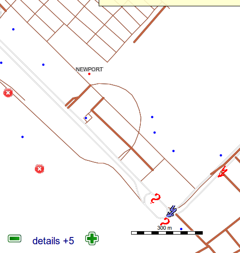
Attached is the test map of the fixme garmin map I made this week. The data are the following: osm - to get unnamed roads (from the noname style) Openstreetbug reports keepright reports In the styles, I mainly recycled unused Marine codes. I also copied existing OSB and keepright icons in the typ. Compile syntax are as follows: time java -Xmx1512m -jar /home/maning/osm/routable_garmin/mkgmap/trunk/dist/mkgmap.jar --code-page=1252 --ea --tdbfile --latin1 --country-abbr=PHI --country-name=PHILIPPINES --remove-short-arcs=5 --transparent --family-id=640 --family-name="FIXME" --ignore-osm-bounds --overview-mapname=40000001 --series-name="FIXME" --description="FIXME" --style-file=/home/maning/osm/routable_garmin/svn/styles/fixme *.osm Now a couple of questions. 1. Even though the points style includes only places=*, osb and keepright code assignment, I still get other POIs in the map (hotels, shops, etc). Why is this so? 2. I activated the transparent switch in order to integrate the map into the regular maps. However, in etrex is see the keepright POIs underneath the roads. On Thu, Apr 1, 2010 at 3:03 AM, WanMil <wmgcnfg@web.de> wrote:
0> In article<4BB0E0B4.9090805@web.de>, 0> WanMil<URL:mailto:wmgcnfg@web.de> ("Wanmil") wrote:
Wanmil> sometimes I create a map that colours the streets depending on Wanmil> their maxspeed tag. I have attached the mkgmap style files and Wanmil> the typ file.
Thanks - I've been intending to do that; I'll have a play with your style. As I colour roads according to their class, I'll make the styles fairly transparent - probably using 3 yellow dots for 30, 4 for 40 and so on (conveniently, we use mph here in GB, so it only needs to go up to 7).
That sounds good! The style was my first contact with the style system and TYP files, so I think some things can be improved for sure! _______________________________________________ mkgmap-dev mailing list mkgmap-dev@lists.mkgmap.org.uk http://www.mkgmap.org.uk/mailman/listinfo/mkgmap-dev
-- cheers, maning ------------------------------------------------------ "Freedom is still the most radical idea of all" -N.Branden wiki: http://esambale.wikispaces.com/ blog: http://epsg4253.wordpress.com/ ------------------------------------------------------

On Apr 18, 2010, at 9:37, maning sambale wrote:
2. I activated the transparent switch in order to integrate the map into the regular maps. However, in etrex is see the keepright POIs underneath the roads.
I think you might want to use the draw-priority option to ensure that your FIXME map is drawn on top of your other maps. Example: --draw-priority=30 Cheers

On 18/04/10 08:37, maning sambale wrote
1. Even though the points style includes only places=*, osb and keepright code assignment, I still get other POIs in the map (hotels, shops, etc). Why is this so?
Your info file includes the lines: # This uses the default style as a base base-style: default This makes the style inherit from the default style, so that you get everything from there too. Just remove that line and you will just see the things that you defined. ..Steve
Thanks to both steve and clinton's suggestions On Sun, Apr 18, 2010 at 6:22 PM, Steve Ratcliffe <steve@parabola.me.uk> wrote:
On 18/04/10 08:37, maning sambale wrote
1. Even though the points style includes only places=*, osb and keepright code assignment, I still get other POIs in the map (hotels, shops, etc). Why is this so?
Your info file includes the lines:
# This uses the default style as a base base-style: default
This makes the style inherit from the default style, so that you get everything from there too. Just remove that line and you will just see the things that you defined.
..Steve
_______________________________________________ mkgmap-dev mailing list mkgmap-dev@lists.mkgmap.org.uk http://www.mkgmap.org.uk/mailman/listinfo/mkgmap-dev
-- cheers, maning ------------------------------------------------------ "Freedom is still the most radical idea of all" -N.Branden wiki: http://esambale.wikispaces.com/ blog: http://epsg4253.wordpress.com/ ------------------------------------------------------
0> In article <f902f9841003282341m501ff578g68213926fdca9822@mail.gmail.com>, 0> maning sambale <URL:mailto:emmanuel.sambale@gmail.com> ("Maning") wrote: Maning> Just got this idea of creating Garmin maps designed for fixing Maning> the data (I use Garmin primarily to collect and fix OSM). I haven't done it yet, but every so often I consider making an overlay of coloured hatching derived from the value of the 'source' tag, so that I can survey stuff that's merely traced or guessed without wasting lots of time on stuff with source=survey.
participants (8)
-
 Christoph Wagner
 -
 Clinton Gladstone
 -
 maning sambale
 -
 Marko Mäkelä
 -
 Nakor Osm
 -
 Steve Ratcliffe
 -
 Toby Speight
 -
 WanMil