how to handle lines and corresponding polygones


The result depends on the OSM object you are looking at. Please give an example that doesn't work as expected. ________________________________________ Von: mkgmap-dev <mkgmap-dev-bounces@lists.mkgmap.org.uk> im Auftrag von Manfred Haiduk <manfred.haiduk@freenet.de> Gesendet: Samstag, 13. April 2019 20:07 An: Development list for mkgmap Betreff: [mkgmap-dev] how to handle lines and corresponding polygones Hi all just struggling about this : in my lines file i use this statement waterway=dam & area!=yes [0x10f00 resolution 24 continue] and the polygon file looks like this waterway=dam & area=yes [0x24 resolution 20] So i thought, if the waterway dam is a closed line it would be shown as polygon and not as a closed line, but it doesn't do this.Where is my fault ?

Hi 1st - check if an earlier rule sets area=... Your lines rule will give a line unless it has area=yes - the way being closed has no effect. Use is_closed() and/or mkgmap:mp_created to change the behaviour to what you want Ticker On Sat, 2019-04-13 at 20:07 +0200, Manfred Haiduk wrote:
Hi all just struggling about this : in my lines file i use this statement waterway=dam & area!=yes [0x10f00 resolution 24 continue] and the polygon file looks like this waterway=dam & area=yes [0x24 resolution 20] So i thought, if the waterway dam is a closed line it would be shown as polygon and not as a closed line, but it doesn't do this.Where is my fault ? _______________________________________________ mkgmap-dev mailing list mkgmap-dev@lists.mkgmap.org.uk http://www.mkgmap.org.uk/mailman/listinfo/mkgmap-dev

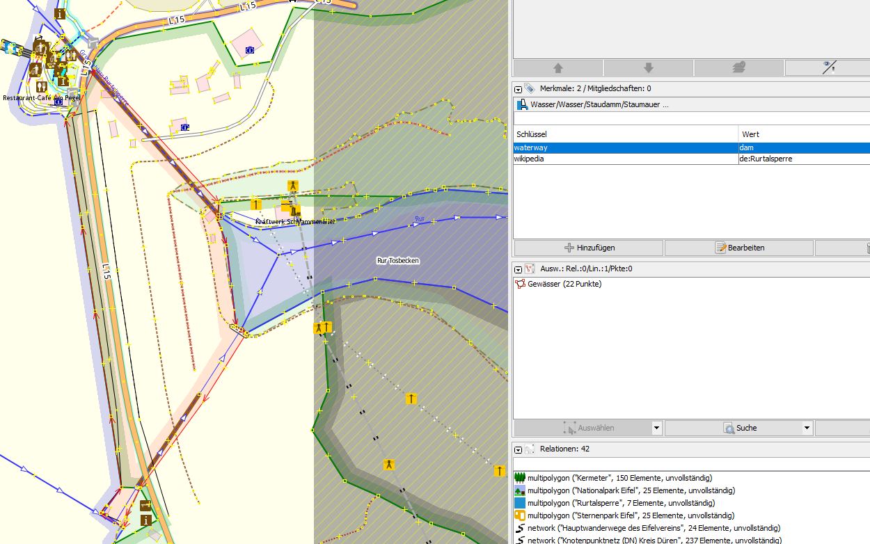
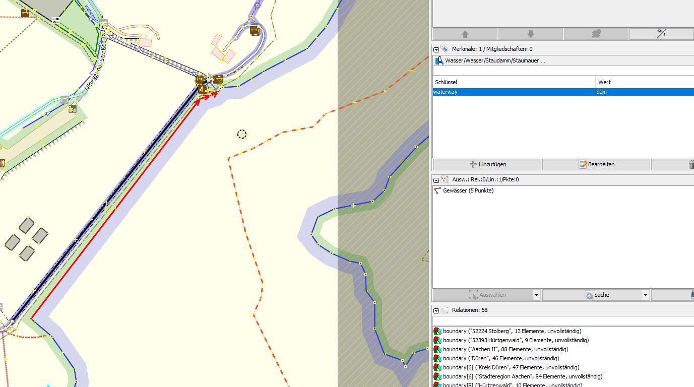
So this is what i'm trying to do. As you can see from the picture "Rur" the tag waterway=dam is a polygon but in the area of the picture "Wehe" the waterway=dam is only a line. Having the statement waterway=dam only in the polygon file, it's quite obvious that mkgmap is rendering the rur area correct but for the whe area there is nothing. Adding waterway=dam also in the lines file, both areas will be shown with the intended line for the dam but the polygon is missing, even if i try to add the area yes or no statement. I know from my runway experiance it should work somehow but for now i'm stopped Am 13.04.2019 um 20:31 schrieb Ticker Berkin:
Hi
1st - check if an earlier rule sets area=...
Your lines rule will give a line unless it has area=yes - the way being closed has no effect.
Use is_closed() and/or mkgmap:mp_created to change the behaviour to what you want
Ticker
On Sat, 2019-04-13 at 20:07 +0200, Manfred Haiduk wrote:
Hi all just struggling about this : in my lines file i use this statement waterway=dam & area!=yes [0x10f00 resolution 24 continue] and the polygon file looks like this waterway=dam & area=yes [0x24 resolution 20] So i thought, if the waterway dam is a closed line it would be shown as polygon and not as a closed line, but it doesn't do this.Where is my fault ? _______________________________________________ mkgmap-dev mailing list mkgmap-dev@lists.mkgmap.org.uk http://www.mkgmap.org.uk/mailman/listinfo/mkgmap-dev
mkgmap-dev mailing list mkgmap-dev@lists.mkgmap.org.uk http://www.mkgmap.org.uk/mailman/listinfo/mkgmap-dev
-- ##################################################### Viele Grüße und 73 de Manfred Haiduk, DD8KQ e-mail mhaiduk@t-online.de dd8kq@gmx.de #####################################################
participants (4)
-
 DD8KQ
DD8KQ -
 Gerd Petermann
 -
 Manfred Haiduk
 -
 Ticker Berkin