
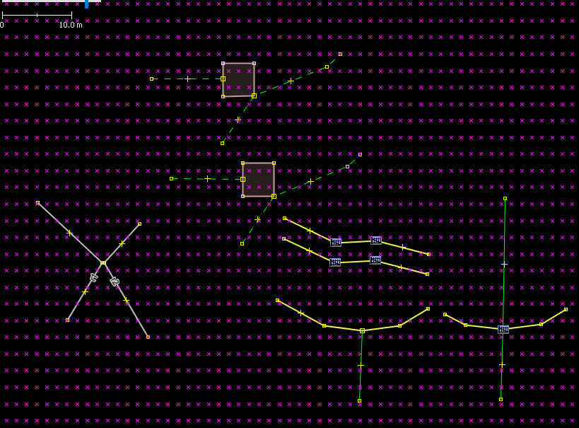
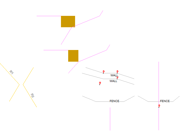
Hi all, as Eric pointed out (1) in rare cases connected ways are rendered as unconnected ways. Reason is an error in WrongAngleFixer which treats roads and lines one after the other. Another problem I found are POIs which created with the --link-pois-to-ways option (nodes with barrier=* or highway=*) . Sometimes the POIs are rendered a few meters away from the way. In opposite to the problem reported by Eric this seems to happen quite often. I've attached my test file with a few special cases that I found and the grid of Garmin points for this area as well as a screenshot from GpsMapEdit. I am working on a better handling of these special cases. I've already found a solution reg. the rendering, still testing the effects on routing... ciao, Gerd (1) http://gis.19327.n8.nabble.com/Connected-ways-rendered-as-Unconnected-ways-d...
participants (1)
-
 Gerd Petermann