
Hii all, r245 is commited. It should fix the issues regarding "too few nodes" in some of the tiles. It tries to find a nice split so that every tile has between <max-nodes/3> and <maxnodes> nodes while also trying to have a nice aspect ratio. If you have problems or if you think the result is not good, please describe why and send the file densities-out.txt and let me know the splitter parameters. ciao, Gerd -- View this message in context: http://gis.19327.n5.nabble.com/splitter-r245-tp5737399.html Sent from the Mkgmap Development mailing list archive at Nabble.com.

Hi Gerd, just a question: Would it be possible to give splitter a polygon-file and splitter generates tiles only for this polygon? Actually splitter generates tiles always for hole bounding-box. It might be possible to have some checks to polygon-file (rectangular, no to small parts). The advantage would be, that no manual tweak of areas.list is necessary. Henning Am 24.11.2012 23:53, schrieb GerdP:
Hii all,
r245 is commited. It should fix the issues regarding "too few nodes" in some of the tiles. It tries to find a nice split so that every tile has between <max-nodes/3> and <maxnodes> nodes while also trying to have a nice aspect ratio.
If you have problems or if you think the result is not good, please describe why and send the file densities-out.txt and let me know the splitter parameters.
ciao, Gerd
Henning Scholland wrote
just a question: Would it be possible to give splitter a polygon-file and splitter generates tiles only for this polygon? Actually splitter generates tiles always for hole bounding-box. It might be possible to have some checks to polygon-file (rectangular, no to small parts). The advantage would be, that no manual tweak of areas.list is necessary.
I've already waited for this question ;-) A few days ago I would have answered: use e.g. osmcomvert --complete-ways --complex-ways -B=polygon-file ... but I found out that osmconvert is not able to detect polygons that enclose the polygon. Splitter is able to do that for a bounding box with the keep-complete option, but up to now splitter doesn't understand polygon-file format. I think it could be useful, I'll look at this when the new split algorithm is done. Gerd -- View this message in context: http://gis.19327.n5.nabble.com/splitter-r245-tp5737399p5737434.html Sent from the Mkgmap Development mailing list archive at Nabble.com.
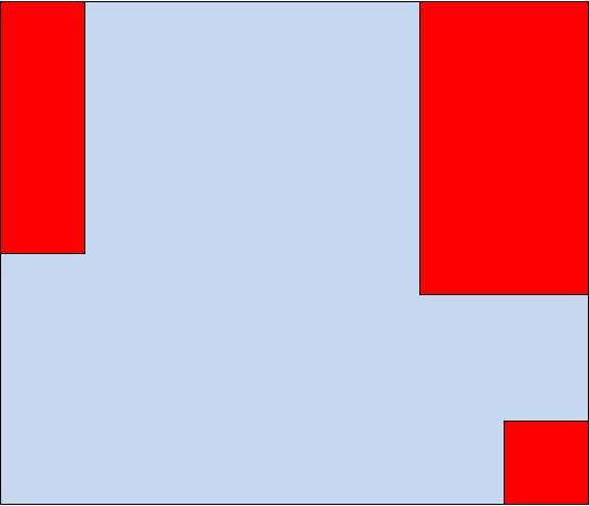
Hi Gerd, I don't know if you understand me correct. The resulting map should be blue area in attached picture. I can cut OSM-data with osmconvert to this polygon. If splitter generates an areas.list for the resulting osm-file, splitter generates a areas.list for red and blue parts. It would be nice, if I can tell splitter only generate tiles for blue area. Henning
Henning Scholland wrote
I don't know if you understand me correct. The resulting map should be blue area in attached picture. I can cut OSM-data with osmconvert to this polygon. If splitter generates an areas.list for the resulting osm-file, splitter generates a areas.list for red and blue parts. It would be nice, if I can tell splitter only generate tiles for blue area.
okay, I understand what you mean. Are you sure that we don't need polygons that do not form rectangles? If we can limit it to a list of rectangles, the change would be quite small. Gerd -- View this message in context: http://gis.19327.n5.nabble.com/splitter-r245-tp5737399p5737444.html Sent from the Mkgmap Development mailing list archive at Nabble.com.
Am 25.11.2012 12:25, schrieb GerdP:
Henning Scholland wrote
I don't know if you understand me correct. The resulting map should be blue area in attached picture. I can cut OSM-data with osmconvert to this polygon. If splitter generates an areas.list for the resulting osm-file, splitter generates a areas.list for red and blue parts. It would be nice, if I can tell splitter only generate tiles for blue area. okay, I understand what you mean. Are you sure that we don't need polygons that do not form rectangles? If we can limit it to a list of rectangles, the change would be quite small. I don't know. AFAIK splitter and mkgmap only supports rectangular tiles till now. So I think only rectangular tiles would be ok. If given polygon isn't rectangular splitter could generate a warning, that only rectangular polygons are allowed.
Henning
Henning Scholland wrote
Am 25.11.2012 12:25, schrieb GerdP:
Henning Scholland wrote
I don't know if you understand me correct. The resulting map should be blue area in attached picture. I can cut OSM-data with osmconvert to this polygon. If splitter generates an areas.list for the resulting osm-file, splitter generates a areas.list for red and blue parts. It would be nice, if I can tell splitter only generate tiles for blue area. okay, I understand what you mean. Are you sure that we don't need polygons that do not form rectangles? If we can limit it to a list of rectangles, the change would be quite small. I don't know. AFAIK splitter and mkgmap only supports rectangular tiles till now. So I think only rectangular tiles would be ok. If given polygon isn't rectangular splitter could generate a warning, that only rectangular polygons are allowed.
I think it would be good to support the osmosis polygon-file format, but probably there is no need to use the precise values. The current splitter just counts the nodes that fall into grid elements. As a first approach I would simply set those grid elements to zero that do not intersect with the polygon. I think this will directly lead to the result that you need. Gerd -- View this message in context: http://gis.19327.n5.nabble.com/splitter-r245-tp5737399p5737490.html Sent from the Mkgmap Development mailing list archive at Nabble.com.
participants (2)
-
 GerdP
GerdP -
 Henning Scholland