
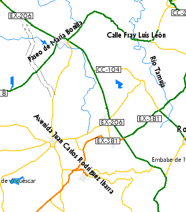
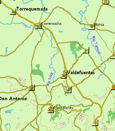
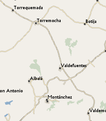
I have the following problem in my maps: at low zoom levels MapSource renders the name of some highway=* objects in places such as villages or cities, but it doesn't show the names of the place=* object. Showing the name of a street in a village you don't know which one is doesn't seem to be very useful. Is there a way to control zoom level at which labels are rendered, independently from the resolution of the named object in the style? Is it possible to give precedence to place=* labels instead of highway=* ones? See attached screenshots of the same area at 5 km zoom level and high detail level from my maps, openfiestmap and openmtbmap to note the difference.

Hi Carlos, For my Openfietsmap I use different lines for highways at different zoom levels. The lines you see when you zoom out have invisible street name labels. Only the highway lines with visible (small font) streetnames are in the highest zoomlewvels (22-23-24) You can set the names of the paths, less important streets also only at zoom 24 and use a different line with invisible name below 24. This way place names are not cluttered by streetname labels.
El 18/06/15 a las 22:28, Minko escribió:
Hi Carlos, For my Openfietsmap I use different lines for highways at different zoom levels. The lines you see when you zoom out have invisible street name labels. Only the highway lines with visible (small font) streetnames are in the highest zoomlewvels (22-23-24) You can set the names of the paths, less important streets also only at zoom 24 and use a different line with invisible name below 24. This way place names are not cluttered by streetname labels. _______________________________________________ mkgmap-dev mailing list mkgmap-dev@lists.mkgmap.org.uk http://www.mkgmap.org.uk/mailman/listinfo/mkgmap-dev
Thanks for the hints Minko. I'm playing with your method and getting much better results now. Just need to adjust the right level for each type of highway.
participants (2)
-
 Carlos Dávila
 -
 Minko
Minko