
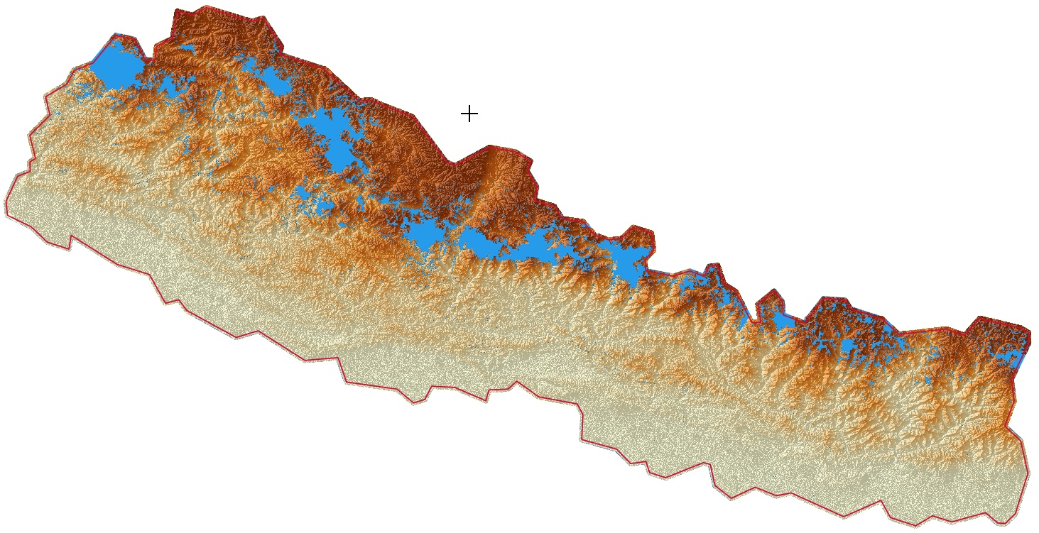
Unfortunately we have no chance for a good shading if the HGT's have so much "holes" (no data values) like nepal. I have made this picture with QGIS. The blue areas are "no data". I don't know, what makes mapsource with this. Frank --- Diese E-Mail wurde von Avast Antivirus-Software auf Viren geprüft. https://www.avast.com/antivirus
A short test with the geo-tiffs from https://earthexplorer.usgs.gov/ (see mail from franco_bez) for nepal show fewer holes. And we have 1" distance! But a login is necessary. I have a little c#-prog based on the gdal-lib for translating between hgt and 16-bit geotiff. Frank --- Diese E-Mail wurde von Avast Antivirus-Software auf Viren geprüft. https://www.avast.com/antivirus
Sorry, here is the jpeg. Frank --- Diese E-Mail wurde von Avast Antivirus-Software auf Viren geprüft. https://www.avast.com/antivirus
Sorry, here is really the jpeg. Frank --- Diese E-Mail wurde von Avast Antivirus-Software auf Viren geprüft. https://www.avast.com/antivirus

Hi Frank, can you give us a compiled version for windows for the geotiff ----> hgt converter ? thomas -------------------------------------------------- Von: "Frank Stinner" <Frank.Stinner@kabelmail.de> Datum: Montag, 1. Januar 2018 18:28 An: <mkgmap-dev@lists.mkgmap.org.uk> Betreff: Re: [mkgmap-dev] DEM and "holes"
A short test with the geo-tiffs from https://earthexplorer.usgs.gov/ (see mail from franco_bez) for nepal show fewer holes. And we have 1" distance! But a login is necessary.
I have a little c#-prog based on the gdal-lib for translating between hgt and 16-bit geotiff.
Frank
--- Diese E-Mail wurde von Avast Antivirus-Software auf Viren geprüft. https://www.avast.com/antivirus
_______________________________________________ mkgmap-dev mailing list mkgmap-dev@lists.mkgmap.org.uk http://www.mkgmap.org.uk/mailman/listinfo/mkgmap-dev

See this tutorial for converting tif to hgt http://www.oruxmaps.com/foro/viewtopic.php?t=3612# <http://www.oruxmaps.com/foro/viewtopic.php?t=3612#> I just created a linux shell script to replace the "tif2hgt.bat" tif2hgt.sh <http://gis.19327.n8.nabble.com/file/t339543/tif2hgt.sh> PS: Just note the "holes" are usually called "voids" -- Sent from: http://gis.19327.n8.nabble.com/Mkgmap-Development-f5324443.html
participants (3)
-
 franco_bez
 -
 Frank Stinner
 -
 Thomas Morgenstern