routing between different maps

Hi, I'm not sure, if I have already written about this problem, sorry if I repeat myself. Routing between maps require external nodes at the same position on both maps. With rectangular tiles external nodes are created only at borders of the tiles (at least this is what I would expect). Different maps most probably do not get the same borders of tiles in common area, co there is no correct external nodes for routing. My idea is to create external nodes at each intersection of administrative border with routable road. Since administrative borders and roads are the same for all maps, then external nodes should appear at exact the same position for all maps. This would allow (I hope, I haven't tested) for seamless routing between maps. From point of view o a user of mkgmap, there could be an option, indicating which borders should be used for creating nodes. Something like: --external-nodes=admin_level2 -- Best regards, Andrzej

Hi Andrzej, I doubt that it is possible. The extracts from Geofabrik overlap at the administrative borders. So a road from e.g. Germany to Poland won't end at the border, but extend a few meters (sometimes even kilometers!) into the neighboring country. And that holds true for that road in the other direction too. This means that the common nodes do already exist, but never did cross-border routing work (note that I changed my toolchain and generate maps containing a few countries because of those issues since a couple of years - I cannot be sure if things have changed meanwhile). Or did I misunderstand the "external nodes"? Kind regards, Bernhard
Hi Bernhard, routable roads contains "nodes", which can be junctions or address points. Only some nodes are marked as "external", mkgmap creates them at borders of tiles. My idea is about creating some additional external nodes, that should be always at the same position, regardless of the way of creating a map. -- Best regards, Andrzej

Hi Andrzej, The idea sounds good to me. I will look at this when I am back. Ciao Gerd ---- Andrzej Popowski schrieb ---- Hi Bernhard, routable roads contains "nodes", which can be junctions or address points. Only some nodes are marked as "external", mkgmap creates them at borders of tiles. My idea is about creating some additional external nodes, that should be always at the same position, regardless of the way of creating a map. -- Best regards, Andrzej _______________________________________________ mkgmap-dev mailing list mkgmap-dev@lists.mkgmap.org.uk http://www.mkgmap.org.uk/mailman/listinfo/mkgmap-dev
Hi all, I've started to look at this. My approach so far: - add a new flag "on-country-border" in the Coord class - collect ways with admin_level=2 contained in the input file (alternative would be to extract them from the bounds file), also way members of matching boundary rels - split those ways into two point segments, so that no segment exists twice - for each road segment calculate the intersection with any of these segments (a spatial index is probably needed), brute force might be too slow - if one is found, either add the intersection node or mark one of the existing nodes if it is very close - make sure that these special nodes are preserved like other boundary nodes - make sure that they are added to the list of external nodes I am not yet sure what to do with roads that share multiple nodes with country borders. Gerd ________________________________________ Von: mkgmap-dev <mkgmap-dev-bounces@lists.mkgmap.org.uk> im Auftrag von Gerd Petermann <gpetermann_muenchen@hotmail.com> Gesendet: Montag, 25. Juni 2018 07:47 An: Development list for mkgmap Betreff: Re: [mkgmap-dev] routing between different maps Hi Andrzej, The idea sounds good to me. I will look at this when I am back. Ciao Gerd ---- Andrzej Popowski schrieb ---- Hi Bernhard, routable roads contains "nodes", which can be junctions or address points. Only some nodes are marked as "external", mkgmap creates them at borders of tiles. My idea is about creating some additional external nodes, that should be always at the same position, regardless of the way of creating a map. -- Best regards, Andrzej _______________________________________________ mkgmap-dev mailing list mkgmap-dev@lists.mkgmap.org.uk http://www.mkgmap.org.uk/mailman/listinfo/mkgmap-dev
Hi Gerd,
I am not yet sure what to do with roads that share multiple nodes with country borders.
I guess, some optimization would be beneficial. This is probably a case, where road goes along a border. If there is a series of consecutive external nodes, you could leave only first, last and nodes which are junctions. This probably should be done at later stages of compilation. Or maybe first and last would be enough? I mean, at a junction there should be an external node added for the second road. -- Best regards, Andrzej
Hi Andrzej, I think the code in the branch (r4211) works quite well now, performance is okay and the number of added external nodes looks reasonable. next on my TODO list: 1) Find good option name and document it. Current code always uses admin_level=2 boundaries. If one splits each German Bundesland and user tries to install e.g. Niedersachsen and Schleswig-Holstein this will not help. So, as you proposed, we might want an option that works like this: --add-ext-nodes-at-borders=x The value x specifies the admin_level. This option tells mkgmap to add so called external routing nodes (NOD3 and NOD4) where roads intersect with boundaries of the given admin_level. Use this if ... 2) Unit tests for the code that checks for intersections Gerd ________________________________________ Von: mkgmap-dev <mkgmap-dev-bounces@lists.mkgmap.org.uk> im Auftrag von Andrzej Popowski <popej@poczta.onet.pl> Gesendet: Mittwoch, 18. Juli 2018 12:54 An: mkgmap-dev@lists.mkgmap.org.uk Betreff: Re: [mkgmap-dev] routing between different maps Hi Gerd,
I am not yet sure what to do with roads that share multiple nodes with country borders.
I guess, some optimization would be beneficial. This is probably a case, where road goes along a border. If there is a series of consecutive external nodes, you could leave only first, last and nodes which are junctions. This probably should be done at later stages of compilation. Or maybe first and last would be enough? I mean, at a junction there should be an external node added for the second road. -- Best regards, Andrzej _______________________________________________ mkgmap-dev mailing list mkgmap-dev@lists.mkgmap.org.uk http://www.mkgmap.org.uk/mailman/listinfo/mkgmap-dev
Hi all, I've now tried routing on my Oregon. I created two different gmapsupp.img with different family-id for Luxembourg and Saarland and routing doesn't seem to work in this case. :-( It works fine when I combine the overlapping tiles into one map (single gmapsupp) Is anybody able to calculate routes between different (Garmin) maps on a device? If not I wonder if this feature is really useful. What would be the use case? Gerd ________________________________________ Von: mkgmap-dev <mkgmap-dev-bounces@lists.mkgmap.org.uk> im Auftrag von Gerd Petermann <gpetermann_muenchen@hotmail.com> Gesendet: Sonntag, 22. Juli 2018 10:05 An: Development list for mkgmap Betreff: Re: [mkgmap-dev] routing between different maps Hi Andrzej, I think the code in the branch (r4211) works quite well now, performance is okay and the number of added external nodes looks reasonable. next on my TODO list: 1) Find good option name and document it. Current code always uses admin_level=2 boundaries. If one splits each German Bundesland and user tries to install e.g. Niedersachsen and Schleswig-Holstein this will not help. So, as you proposed, we might want an option that works like this: --add-ext-nodes-at-borders=x The value x specifies the admin_level. This option tells mkgmap to add so called external routing nodes (NOD3 and NOD4) where roads intersect with boundaries of the given admin_level. Use this if ... 2) Unit tests for the code that checks for intersections Gerd ________________________________________ Von: mkgmap-dev <mkgmap-dev-bounces@lists.mkgmap.org.uk> im Auftrag von Andrzej Popowski <popej@poczta.onet.pl> Gesendet: Mittwoch, 18. Juli 2018 12:54 An: mkgmap-dev@lists.mkgmap.org.uk Betreff: Re: [mkgmap-dev] routing between different maps Hi Gerd,
I am not yet sure what to do with roads that share multiple nodes with country borders.
I guess, some optimization would be beneficial. This is probably a case, where road goes along a border. If there is a series of consecutive external nodes, you could leave only first, last and nodes which are junctions. This probably should be done at later stages of compilation. Or maybe first and last would be enough? I mean, at a junction there should be an external node added for the second road. -- Best regards, Andrzej _______________________________________________ mkgmap-dev mailing list mkgmap-dev@lists.mkgmap.org.uk http://www.mkgmap.org.uk/mailman/listinfo/mkgmap-dev _______________________________________________ mkgmap-dev mailing list mkgmap-dev@lists.mkgmap.org.uk http://www.mkgmap.org.uk/mailman/listinfo/mkgmap-dev

Hi Gerd, haven't tried it, but would be surprised if it's supported as it is not the Garmin way... They want you to send all the map tiles by Garmin software to the GPS. But if this can work with mkgmap it's another step. Now we need the non-rectangular tiles... 😉 Henning On 23 Jul 2018, 13:00, at 13:00, Gerd Petermann <gpetermann_muenchen@hotmail.com> wrote:
Hi all,
I've now tried routing on my Oregon. I created two different gmapsupp.img with different family-id for Luxembourg and Saarland and routing doesn't seem to work in this case. :-( It works fine when I combine the overlapping tiles into one map (single gmapsupp) Is anybody able to calculate routes between different (Garmin) maps on a device? If not I wonder if this feature is really useful. What would be the use case?
Gerd
________________________________________ Von: mkgmap-dev <mkgmap-dev-bounces@lists.mkgmap.org.uk> im Auftrag von Gerd Petermann <gpetermann_muenchen@hotmail.com> Gesendet: Sonntag, 22. Juli 2018 10:05 An: Development list for mkgmap Betreff: Re: [mkgmap-dev] routing between different maps
Hi Andrzej,
I think the code in the branch (r4211) works quite well now, performance is okay and the number of added external nodes looks reasonable.
next on my TODO list: 1) Find good option name and document it. Current code always uses admin_level=2 boundaries. If one splits each German Bundesland and user tries to install e.g. Niedersachsen and Schleswig-Holstein this will not help. So, as you proposed, we might want an option that works like this: --add-ext-nodes-at-borders=x The value x specifies the admin_level. This option tells mkgmap to add so called external routing nodes (NOD3 and NOD4) where roads intersect with boundaries of the given admin_level. Use this if ... 2) Unit tests for the code that checks for intersections
Gerd
________________________________________ Von: mkgmap-dev <mkgmap-dev-bounces@lists.mkgmap.org.uk> im Auftrag von Andrzej Popowski <popej@poczta.onet.pl> Gesendet: Mittwoch, 18. Juli 2018 12:54 An: mkgmap-dev@lists.mkgmap.org.uk Betreff: Re: [mkgmap-dev] routing between different maps
Hi Gerd,
I am not yet sure what to do with roads that share multiple nodes with country borders.
I guess, some optimization would be beneficial. This is probably a case, where road goes along a border. If there is a series of consecutive external nodes, you could leave only first, last and nodes which are junctions. This probably should be done at later stages of compilation.
Or maybe first and last would be enough? I mean, at a junction there should be an external node added for the second road.
-- Best regards, Andrzej _______________________________________________ mkgmap-dev mailing list mkgmap-dev@lists.mkgmap.org.uk http://www.mkgmap.org.uk/mailman/listinfo/mkgmap-dev _______________________________________________ mkgmap-dev mailing list mkgmap-dev@lists.mkgmap.org.uk http://www.mkgmap.org.uk/mailman/listinfo/mkgmap-dev _______________________________________________ mkgmap-dev mailing list mkgmap-dev@lists.mkgmap.org.uk http://www.mkgmap.org.uk/mailman/listinfo/mkgmap-dev
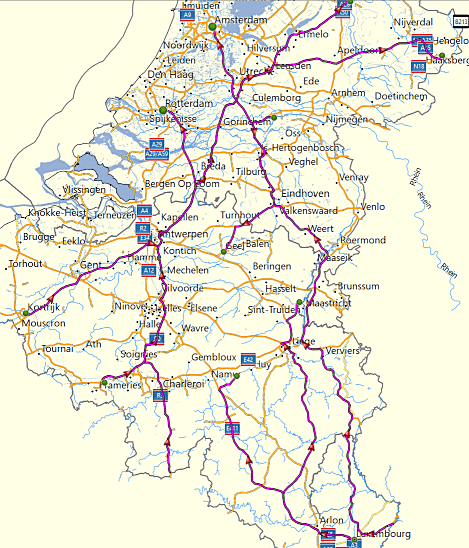
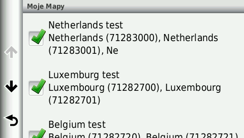
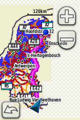
Hi, I have extended my test batch to create independent maps of Belgium, Luxemburg and Netherlands, scripts are attached to this mail. For me mkgmap r4211 works correctly. There is no problems in BaseCamp (see attached picture imroute1.png). Nuvi 2340 with 3 separate maps works correctly (pictures imroute2-4). There is problem with displaying maps around border. Nuvi shows only one maps, which results with some empty areas (picture imroute5). Garmin Dakota works correctly (picture imroute6). Both maps are displayed at the border and there is no empty area. Gerd, what were options for routes in your Oregon? I have used routing for car, because this mode easily calculates longer routes. -- Best regards, Andrzej
Hi Andrzej, I also used car and no avoidances. Maybe the difference is that I used mkgmap to create different gmapsupp files. When I transfer the overlapping times from the "benelux " map using Mapsource routing works, when I install the different gmapsupp files created by mkgmap routing doesn't work. How did you transfer the maps to the device? Gerd ________________________________________ Von: mkgmap-dev <mkgmap-dev-bounces@lists.mkgmap.org.uk> im Auftrag von Andrzej Popowski <popej@poczta.onet.pl> Gesendet: Montag, 23. Juli 2018 19:52 An: mkgmap-dev@lists.mkgmap.org.uk Betreff: Re: [mkgmap-dev] routing between different maps Hi, I have extended my test batch to create independent maps of Belgium, Luxemburg and Netherlands, scripts are attached to this mail. For me mkgmap r4211 works correctly. There is no problems in BaseCamp (see attached picture imroute1.png). Nuvi 2340 with 3 separate maps works correctly (pictures imroute2-4). There is problem with displaying maps around border. Nuvi shows only one maps, which results with some empty areas (picture imroute5). Garmin Dakota works correctly (picture imroute6). Both maps are displayed at the border and there is no empty area. Gerd, what were options for routes in your Oregon? I have used routing for car, because this mode easily calculates longer routes. -- Best regards, Andrzej
Hi Andrzej, I've attached my test env. I renamed the two gmapsupp.img and copied them on the device. Next, I used the older (combined) map in MapSource to calculate some routes which cross several tiles and transferred those routes to the device. Finally I look at the routes in the device. With two gmapsupp I got straight lines. So, I transferred the combined map from MapSource to the device and removed the separate gmapsupp. With this configuration I got nice routes. Gerd ________________________________________ Von: mkgmap-dev <mkgmap-dev-bounces@lists.mkgmap.org.uk> im Auftrag von Gerd Petermann <gpetermann_muenchen@hotmail.com> Gesendet: Montag, 23. Juli 2018 21:47 An: Development list for mkgmap Betreff: Re: [mkgmap-dev] routing between different maps Hi Andrzej, I also used car and no avoidances. Maybe the difference is that I used mkgmap to create different gmapsupp files. When I transfer the overlapping times from the "benelux " map using Mapsource routing works, when I install the different gmapsupp files created by mkgmap routing doesn't work. How did you transfer the maps to the device? Gerd ________________________________________ Von: mkgmap-dev <mkgmap-dev-bounces@lists.mkgmap.org.uk> im Auftrag von Andrzej Popowski <popej@poczta.onet.pl> Gesendet: Montag, 23. Juli 2018 19:52 An: mkgmap-dev@lists.mkgmap.org.uk Betreff: Re: [mkgmap-dev] routing between different maps Hi, I have extended my test batch to create independent maps of Belgium, Luxemburg and Netherlands, scripts are attached to this mail. For me mkgmap r4211 works correctly. There is no problems in BaseCamp (see attached picture imroute1.png). Nuvi 2340 with 3 separate maps works correctly (pictures imroute2-4). There is problem with displaying maps around border. Nuvi shows only one maps, which results with some empty areas (picture imroute5). Garmin Dakota works correctly (picture imroute6). Both maps are displayed at the border and there is no empty area. Gerd, what were options for routes in your Oregon? I have used routing for car, because this mode easily calculates longer routes. -- Best regards, Andrzej _______________________________________________ mkgmap-dev mailing list mkgmap-dev@lists.mkgmap.org.uk http://www.mkgmap.org.uk/mailman/listinfo/mkgmap-dev
Hi Gerd, In my test, I have used MapInstall to create 3 separate img for GPS. I have run your scripts, then copied 2 created gmapsupp.img to GPS (I have renamed second one as gmapsup1.img). It works correctly for me, both in nuvi and in Dakota. See attached picture form Dakota. I have no idea, what goes wrong in your Oregon. Maybe there is some interaction with basemap? Basemap is routable and sometimes can be used for calculation. -- Best regards, Andrzej
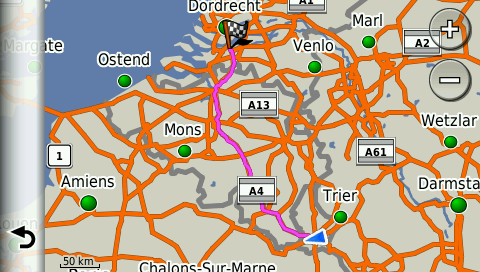
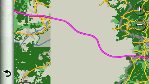
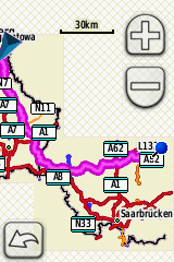
Hi Andrzej, I think your screenshot shows a route between two tiles of the same map. I've tested with routes crossing the maps, e.g. from Luxembourg to Merzig. I tried also with disabled Basemap, no change. Attached are my test routes. Gerd ________________________________________ Von: mkgmap-dev <mkgmap-dev-bounces@lists.mkgmap.org.uk> im Auftrag von Andrzej Popowski <popej@poczta.onet.pl> Gesendet: Dienstag, 24. Juli 2018 16:12 An: mkgmap-dev@lists.mkgmap.org.uk Betreff: Re: [mkgmap-dev] routing between different maps Hi Gerd, In my test, I have used MapInstall to create 3 separate img for GPS. I have run your scripts, then copied 2 created gmapsupp.img to GPS (I have renamed second one as gmapsup1.img). It works correctly for me, both in nuvi and in Dakota. See attached picture form Dakota. I have no idea, what goes wrong in your Oregon. Maybe there is some interaction with basemap? Basemap is routable and sometimes can be used for calculation. -- Best regards, Andrzej
Hi Andrzej, sorry, your screenshot also shows a route between maps. Please check how my routes work on your devices. Gerd ________________________________________ Von: mkgmap-dev <mkgmap-dev-bounces@lists.mkgmap.org.uk> im Auftrag von Gerd Petermann <gpetermann_muenchen@hotmail.com> Gesendet: Mittwoch, 25. Juli 2018 06:54 An: Development list for mkgmap Betreff: Re: [mkgmap-dev] routing between different maps Hi Andrzej, I think your screenshot shows a route between two tiles of the same map. I've tested with routes crossing the maps, e.g. from Luxembourg to Merzig. I tried also with disabled Basemap, no change. Attached are my test routes. Gerd ________________________________________ Von: mkgmap-dev <mkgmap-dev-bounces@lists.mkgmap.org.uk> im Auftrag von Andrzej Popowski <popej@poczta.onet.pl> Gesendet: Dienstag, 24. Juli 2018 16:12 An: mkgmap-dev@lists.mkgmap.org.uk Betreff: Re: [mkgmap-dev] routing between different maps Hi Gerd, In my test, I have used MapInstall to create 3 separate img for GPS. I have run your scripts, then copied 2 created gmapsupp.img to GPS (I have renamed second one as gmapsup1.img). It works correctly for me, both in nuvi and in Dakota. See attached picture form Dakota. I have no idea, what goes wrong in your Oregon. Maybe there is some interaction with basemap? Basemap is routable and sometimes can be used for calculation. -- Best regards, Andrzej
Hi Andrzej, I've now created a route between different maps on the device, that seems to work fine. Gerd ________________________________________ Von: mkgmap-dev <mkgmap-dev-bounces@lists.mkgmap.org.uk> im Auftrag von Gerd Petermann <gpetermann_muenchen@hotmail.com> Gesendet: Mittwoch, 25. Juli 2018 06:57 An: Development list for mkgmap Betreff: Re: [mkgmap-dev] routing between different maps Hi Andrzej, sorry, your screenshot also shows a route between maps. Please check how my routes work on your devices. Gerd ________________________________________ Von: mkgmap-dev <mkgmap-dev-bounces@lists.mkgmap.org.uk> im Auftrag von Gerd Petermann <gpetermann_muenchen@hotmail.com> Gesendet: Mittwoch, 25. Juli 2018 06:54 An: Development list for mkgmap Betreff: Re: [mkgmap-dev] routing between different maps Hi Andrzej, I think your screenshot shows a route between two tiles of the same map. I've tested with routes crossing the maps, e.g. from Luxembourg to Merzig. I tried also with disabled Basemap, no change. Attached are my test routes. Gerd ________________________________________ Von: mkgmap-dev <mkgmap-dev-bounces@lists.mkgmap.org.uk> im Auftrag von Andrzej Popowski <popej@poczta.onet.pl> Gesendet: Dienstag, 24. Juli 2018 16:12 An: mkgmap-dev@lists.mkgmap.org.uk Betreff: Re: [mkgmap-dev] routing between different maps Hi Gerd, In my test, I have used MapInstall to create 3 separate img for GPS. I have run your scripts, then copied 2 created gmapsupp.img to GPS (I have renamed second one as gmapsup1.img). It works correctly for me, both in nuvi and in Dakota. See attached picture form Dakota. I have no idea, what goes wrong in your Oregon. Maybe there is some interaction with basemap? Basemap is routable and sometimes can be used for calculation. -- Best regards, Andrzej _______________________________________________ mkgmap-dev mailing list mkgmap-dev@lists.mkgmap.org.uk http://www.mkgmap.org.uk/mailman/listinfo/mkgmap-dev
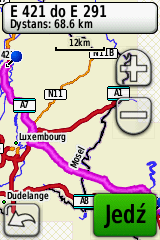
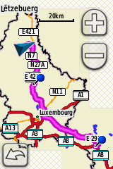
Hi Gerd, I have imported your routes to BaseCamp and then sent to Dakota. It looks ok. When I select route as a destination, Dakota shows route for a moment as a straight line and then recalculates on roads, see pic "go-to". If I start navigation, then Dakota calculates again, adding a leg to starting point of selected route, see pic "route". -- Best regards, Andrzej
Hi Andrzej, okay, seems there are many ways to test this ;-) I've created the routes in MapSource and transferred them to the Oregon. Next, I looked at them in the Route Manager. With other routes, when I select button "Map" in the Route Manager the route is also first displayed as a straight line and then recalculated. Only with these map crossing ways I don't see a recalculation. Interesting is that I see recalculation when I select a different default route vehicle, but the results look bad. Anyway, I think the extra nodes can improve routing, so I'll add an option to specify the admin_level. Gerd ________________________________________ Von: mkgmap-dev <mkgmap-dev-bounces@lists.mkgmap.org.uk> im Auftrag von Andrzej Popowski <popej@poczta.onet.pl> Gesendet: Donnerstag, 26. Juli 2018 13:01 An: mkgmap-dev@lists.mkgmap.org.uk Betreff: Re: [mkgmap-dev] routing between different maps Hi Gerd, I have imported your routes to BaseCamp and then sent to Dakota. It looks ok. When I select route as a destination, Dakota shows route for a moment as a straight line and then recalculates on roads, see pic "go-to". If I start navigation, then Dakota calculates again, adding a leg to starting point of selected route, see pic "route". -- Best regards, Andrzej
Hi Gerd, in my opinion this is valuable change and should be merged to trunk. I would even suggest to use admin level 2 as default. This would lead to compatibility between maps, even if authors are unaware of this feature. -- Best regards, Andrzej
Hi Gerd, How much performance does it take? Wouldn't it be better to create those nodes automatically at every level 2 and 4 boundary and give a possibility to define a individual poly for it for any other special case? Henning On 26 Jul 2018, 19:23, at 19:23, Gerd Petermann <gpetermann_muenchen@hotmail.com> wrote:
Hi Andrzej,
okay, seems there are many ways to test this ;-) I've created the routes in MapSource and transferred them to the Oregon. Next, I looked at them in the Route Manager. With other routes, when I select button "Map" in the Route Manager the route is also first displayed as a straight line and then recalculated. Only with these map crossing ways I don't see a recalculation. Interesting is that I see recalculation when I select a different default route vehicle, but the results look bad.
Anyway, I think the extra nodes can improve routing, so I'll add an option to specify the admin_level.
Gerd
________________________________________ Von: mkgmap-dev <mkgmap-dev-bounces@lists.mkgmap.org.uk> im Auftrag von Andrzej Popowski <popej@poczta.onet.pl> Gesendet: Donnerstag, 26. Juli 2018 13:01 An: mkgmap-dev@lists.mkgmap.org.uk Betreff: Re: [mkgmap-dev] routing between different maps
Hi Gerd,
I have imported your routes to BaseCamp and then sent to Dakota. It looks ok. When I select route as a destination, Dakota shows route for a moment as a straight line and then recalculates on roads, see pic "go-to". If I start navigation, then Dakota calculates again, adding a leg to starting point of selected route, see pic "route".
-- Best regards, Andrzej _______________________________________________ mkgmap-dev mailing list mkgmap-dev@lists.mkgmap.org.uk http://www.mkgmap.org.uk/mailman/listinfo/mkgmap-dev
Hi Henning, reg. performance: I think it is now clearly less then 1 s per tile for level 2 boundaries. reg. option: I see two ways to control this: 1) style rules may set a special tag mkgmap:xyz on those lines which should be considered as boundaries. I have no idea how to name such a tag, and user would need some rules in style files relations and lines / polygons. 2) an option like --add-boundary-nodes-at-admin-boundary=[level] The level parameter would default to 2, if e.g. 4 is given, all boundaries with levels <= 4 would be used. In both cases you can add your individual poly to the OSM data, e.g. a way with tags boundary=administrative ,admin_level=2 , and render=no and check the render tag in the style so that the way is not added to the map. I think I'll implement 2) now, looks like the safer way to me. Gerd ________________________________________ Von: mkgmap-dev <mkgmap-dev-bounces@lists.mkgmap.org.uk> im Auftrag von Henning Scholland <osm@hscholland.de> Gesendet: Freitag, 27. Juli 2018 02:36 An: Development list for mkgmap Cc: Andrzej Popowski Betreff: Re: [mkgmap-dev] routing between different maps Hi Gerd, How much performance does it take? Wouldn't it be better to create those nodes automatically at every level 2 and 4 boundary and give a possibility to define a individual poly for it for any other special case? Henning On 26 Jul 2018, 19:23, at 19:23, Gerd Petermann <gpetermann_muenchen@hotmail.com> wrote:
Hi Andrzej,
okay, seems there are many ways to test this ;-) I've created the routes in MapSource and transferred them to the Oregon. Next, I looked at them in the Route Manager. With other routes, when I select button "Map" in the Route Manager the route is also first displayed as a straight line and then recalculated. Only with these map crossing ways I don't see a recalculation. Interesting is that I see recalculation when I select a different default route vehicle, but the results look bad.
Anyway, I think the extra nodes can improve routing, so I'll add an option to specify the admin_level.
Gerd
________________________________________ Von: mkgmap-dev <mkgmap-dev-bounces@lists.mkgmap.org.uk> im Auftrag von Andrzej Popowski <popej@poczta.onet.pl> Gesendet: Donnerstag, 26. Juli 2018 13:01 An: mkgmap-dev@lists.mkgmap.org.uk Betreff: Re: [mkgmap-dev] routing between different maps
Hi Gerd,
I have imported your routes to BaseCamp and then sent to Dakota. It looks ok. When I select route as a destination, Dakota shows route for a moment as a straight line and then recalculates on roads, see pic "go-to". If I start navigation, then Dakota calculates again, adding a leg to starting point of selected route, see pic "route".
-- Best regards, Andrzej _______________________________________________ mkgmap-dev mailing list mkgmap-dev@lists.mkgmap.org.uk http://www.mkgmap.org.uk/mailman/listinfo/mkgmap-dev
Hi Gerd, one more note: all routes in my test has been calculated in devices. I turn on GPS simulation, set current position somewhere inside map area, then browse map and point a destination. If you transfer routes form Mapsource, then maybe you should force recalculation in device? -- Best regards, Andrzej
participants (4)
-
 Andrzej Popowski
 -
 Bernhard Hiller
 -
 Gerd Petermann
 -
 Henning Scholland