Question to --add-pois-to-areas

Hi! How should --add-pois-to-areas work? Here is a Zoo:http://www.openstreetmap.org/?lat=28.40885&lon=-16.56398&zoom=17&layers=B000... but it has got neighter icon nor can it be found in the POI search. How is this option expected to work? TIA, Dani P.S: This part is very small so maps are generated very fast: http://download.geofabrik.de/osm/africa/canary_islands.osm.bz2

Daniela Duerbeck escribió:
Hi!
How should --add-pois-to-areas work? Here is a Zoo:http://www.openstreetmap.org/?lat=28.40885&lon=-16.56398&zoom=17&layers=B000... but it has got neighter icon nor can it be found in the POI search. How is this option expected to work?
TIA, Dani
P.S: This part is very small so maps are generated very fast: http://download.geofabrik.de/osm/africa/canary_islands.osm.bz2 _______________________________________________ mkgmap-dev mailing list mkgmap-dev@lists.mkgmap.org.uk http://www.mkgmap.org.uk/mailman/listinfo/mkgmap-dev
First off all, you may need to add an area=yes tag to the polygon, in order to mkgmap know it's an area. Second, you need a corresponding tourism=zoo line in your points file, otherwise the poi won't be created.
Carlos Dávila escribió:
Daniela Duerbeck escribió:
Hi!
How should --add-pois-to-areas work? Here is a Zoo:http://www.openstreetmap.org/?lat=28.40885&lon=-16.56398&zoom=17&layers=B000... but it has got neighter icon nor can it be found in the POI search. How is this option expected to work?
TIA, Dani
P.S: This part is very small so maps are generated very fast: http://download.geofabrik.de/osm/africa/canary_islands.osm.bz2 _______________________________________________ mkgmap-dev mailing list mkgmap-dev@lists.mkgmap.org.uk http://www.mkgmap.org.uk/mailman/listinfo/mkgmap-dev
First off all, you may need to add an area=yes tag to the polygon, in order to mkgmap know it's an area. Second, you need a corresponding tourism=zoo line in your points file, otherwise the poi won't be created. I've seen we have amenity=zoo in the default points style, but in the wiki zoos are said to be tagged as tourism=zoo. Probably we should add the latter to default style.
Hi Carlos!
I've seen we have amenity=zoo in the default points style, but in the wiki zoos are said to be tagged as tourism=zoo. Probably we should add the latter to default style.
It was already inside the points file. Should then also buildings get an area=yes (e.g. here "my" Aldi-Supermarket: http://www.openstreetmap.org/?lat=48.090925&lon=11.507215&zoom=18&layers=B00...) or do we need an additional --add-poi-to-buildings beside add-poi-to-areas? TIA, Dani

2010/3/28 Daniela Duerbeck <daniela.duerbeck@gmx.de>:
Hi Carlos!
I've seen we have amenity=zoo in the default points style, but in the wiki zoos are said to be tagged as tourism=zoo. Probably we should add the latter to default style.
It was already inside the points file. Should then also buildings get an area=yes (e.g. here "my" Aldi-Supermarket: http://www.openstreetmap.org/?lat=48.090925&lon=11.507215&zoom=18&layers=B00...) or do we need an additional --add-poi-to-buildings beside add-poi-to-areas?
No, area=yes is not needed, because as opposed to a node, when a way gets tagged with "building=*", it's clear that it's meant to be an area. You only need area=yes for ways that normally aren't areas, such as highway=residential. -Martin
Hi Martin!
No, area=yes is not needed, because as opposed to a node, when a way gets tagged with "building=*", it's clear that it's meant to be an area. You only need area=yes for ways that normally aren't areas, such as highway=residential.
But the Aldi is not found when I search for Supermarkets or by Name. TIA, Dani
2010/3/29 Daniela Duerbeck <daniela.duerbeck@gmx.de>:
Hi Martin!
No, area=yes is not needed, because as opposed to a node, when a way gets tagged with "building=*", it's clear that it's meant to be an area. You only need area=yes for ways that normally aren't areas, such as highway=residential.
But the Aldi is not found when I search for Supermarkets or by Name.
OK, I just checked my own garmin map and the Aldi is present and searchable. It was catched by this line in my points-file: shop=supermarket [0x2e02 resolution 20] Looks like some rule catched it before. Do you have a rule for buildings or housenumbers in your points-file? And is it above the supermarket rule? if so, just move it somewhere below - always make sure the "more important" rules are on top or use "continue" if you want both to be triggered. -Martin
I added a polygon in my typfile (0x1b) for tourism=zoo and added tourism=zoo [0x1b resolution 18] in my polygons file. But this zoo gets still no generated POI. What am I doing wrong? I also used the latest mkgmap. Dani
Carlos Dávila wrote:
First off all, you may need to add an area=yes tag to the polygon, in order to mkgmap know it's an area. Second, you need a corresponding tourism=zoo line in your points file, otherwise the poi won't be created.
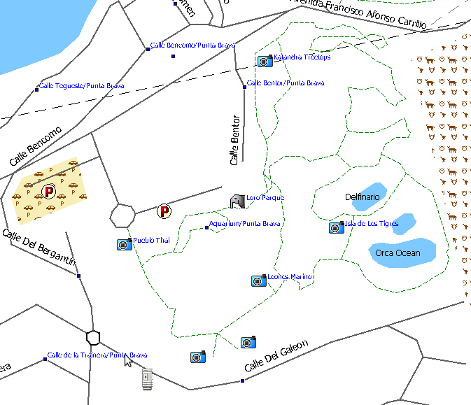
Now there is both: area=yes, and a correct points file, but no Loro Parque. Do you have this POI in your Canary map? TIA, Dani
Daniela Duerbeck escribió:
Carlos Dávila wrote:
First off all, you may need to add an area=yes tag to the polygon, in order to mkgmap know it's an area. Second, you need a corresponding tourism=zoo line in your points file, otherwise the poi won't be created.
Now there is both: area=yes, and a correct points file, but no Loro Parque. Do you have this POI in your Canary map? Sorry for the late response, I've been away a few days. Yes, MapSource (6.13.7) shows a POI for Loro Parque (see screenshot). I have tourism=zoo & amenity=zoo [0x2c07 resolution 20] in my points file and also an entry for zoos in polygons file. FYI, if I try to search for that POI, it does appear in the search list, but MS crashes. Not tested in gps.
Hi All! Now I solved my problem with the add-pois-to-areas but I do not completely understand it. With this line in the options file, I do not get POIs: levels = 0:23, 1:22, 2:21, 3:20, 4:19, 5:18, 6:16, 7:12 This line works fine: levels = 0:24, 1:22, 2:20, 3:18, 4:16, 5:12 What is wrong with the first line? TIA, Dani

On 06.04.2010 16:38, Daniela Duerbeck wrote:
Hi All!
Now I solved my problem with the add-pois-to-areas but I do not completely understand it. With this line in the options file, I do not get POIs: levels = 0:23, 1:22, 2:21, 3:20, 4:19, 5:18, 6:16, 7:12
This line works fine: levels = 0:24, 1:22, 2:20, 3:18, 4:16, 5:12
What is wrong with the first line?
Mkgmap has some bugs, if you create maps with empty resolution 24. Another one I found, was that streets have holes as the dp-filter is not working correctly if resolution=24 is not present. I only successfully created maps without 24, for contourline only maps.
TIA, Dani
_______________________________________________ mkgmap-dev mailing list mkgmap-dev@lists.mkgmap.org.uk http://www.mkgmap.org.uk/mailman/listinfo/mkgmap-dev
participants (4)
-
 Carlos Dávila
 -
 Daniela Duerbeck
 -
 Felix Hartmann
 -
 Martin Simon