
Is it possible to render seamarks eg lighthouses with sectors shown as per open sea map with mkgmap if so is there a style file available -- View this message in context: http://gis.19327.n5.nabble.com/Marine-style-tp5743401.html Sent from the Mkgmap Development mailing list archive at Nabble.com.

On Tue, Jan 08, 2013 at 06:04:48AM -0800, gbbickerton wrote:
Is it possible to render seamarks eg lighthouses with sectors shown as per open sea map with mkgmap if so is there a style file available
Did you already try the --style=marine that is included with mkgmap? Marko

On 08/01/2013 14:04, gbbickerton wrote:
Is it possible to render seamarks eg lighthouses with sectors shown as per open sea map with mkgmap if so is there a style file available
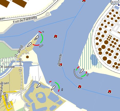
Many seamark symbols are built into Garmin devices which are available when the device is in marine mode. There is no in-built facility to render light sectors. OpenSeaMap use purpose-written renderers to do this for their charts. A contributor to this list, RheinSkipper, had done a lot of work to fully exploit the Garmin marine mode. Hopefully he will respond to this thread to explain more.

Is it possible to render seamarks eg lighthouses with sectors shown as per open sea map with mkgmap if so is there a style file available
Many seamark symbols are built into Garmin devices which are available when the device is in marine mode. There is no in-built facility to render light sectors. OpenSeaMap use purpose-written renderers to do this for their charts.
A contributor to this list, RheinSkipper, had done a lot of work to fully exploit the Garmin marine mode. Hopefully he will respond to this thread to explain more.
Yes, light sectors are built in some Garmin devices and in MapSource. Mkgmap includes a sample marine style which already makes use of this. You have to download the source version of mkgmap and browse the resources folder to find it. If you want to make use of this on a handheld device, here is an easy workflow: http://wiki.openstreetmap.org/wiki/User:Sparcuser If you want to make a map for Garmin fix mount marine devices things become much more complicated. There are a couple of problems unresolved, yet. I had to make a lot of compromises and workarounds for my map which is made especially for marine devices ( http://wiki.openstreetmap.org/wiki/DE:OpenSeaMap_and_Garmin_nautical_chart_p lotter ). But light sectors work fine (they do not appear on my sample screenshots because I switched them off in my device). Unfortunately the marine style that comes with mkgmap is somehow outdated. Newer Openseamap tagging is not yet included. So feel free to improve it! RheinSkipper
Thanks I found the marine style I did not know that the stuff on github existed Mapsource shows sectors but Basecamp does not I have found. I am not making a map for marine use I just wanted to add some interesting marine stuff to my maps. Barry -- View this message in context: http://gis.19327.n5.nabble.com/Marine-style-tp5743401p5743543.html Sent from the Mkgmap Development mailing list archive at Nabble.com.
Is there a type file to go with the marine style or does it rely on default symbols? also could someone explain what is happening in this line please seamark:light:ref=* { add mkgmap:xt-int-desig='${seamark:light:ref}'; } Barry -- View this message in context: http://gis.19327.n5.nabble.com/Marine-style-tp5743401p5746427.html Sent from the Mkgmap Development mailing list archive at Nabble.com.
participants (4)
-
 gbbickerton
 -
 Malcolm Herring
 -
 Marko Mäkelä
 -
 RheinSkipper