Gap in the street and unusual routing

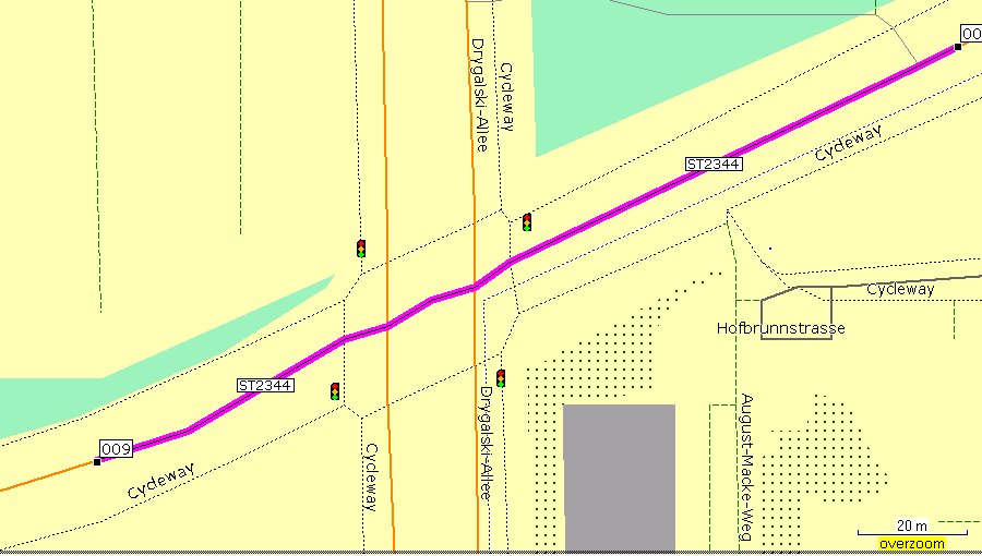
Hi! One street shoes a gap that does not seem to be in the osm data: http://www.deltadelta.de/nmz/sc21.png vs. http://www.openstreetmap.org/?lat=48.08617&lon=11.50167&zoom=17&layers=B000F... I tried to navigate to the "Bad Forstenrieder Park". Since one can not pass this gap, the route went to Drygalski Allee, Herterichstr, then right and then to the grade3 path through the farmland. But I used car/motorcycle. What have I to put i which file so that routing goes not across unpaved tracks? TIA, Dani P.S: mkgmap 1597

Hi Dani,
What have I to put i which file so that routing goes not across unpaved tracks?
Please look at the default style, resources/style/default/lines, for mkgmap:unpaved=1, and set "Avoid unpaved roads" in the routing options on your device. Side note: I wish there were a widely used tag for "badly ploughed roads". In winter, unpaved roads can be more pleasant to ride than badly ploughed paved roads, even with a car. Marko
Hi Marko!
Please look at the default style, resources/style/default/lines, for mkgmap:unpaved=1, and set "Avoid unpaved roads" in the routing options on your device.
Now it hops also over the gap. Funny, the now chosen route is also much shorter than the first one. :-)) Thanks a lot! Dani

Hi Daniela,
Hi!
One street shoes a gap that does not seem to be in the osm data: http://www.deltadelta.de/nmz/sc21.png vs. http://www.openstreetmap.org/?lat=48.08617&lon=11.50167&zoom=17&layers=B000F...
I tried to navigate to the "Bad Forstenrieder Park". Since one can not pass this gap, the route went to Drygalski Allee, Herterichstr, then right and then to the grade3 path through the farmland. But I used car/motorcycle. What have I to put i which file so that routing goes not across unpaved tracks?
TIA, Dani
P.S: mkgmap 1597
Hmm, can't explain that - see attached pic showing mapsource routing through that junction - mkgmap version 1598, current OSM data. Cheers, Mark

participants (4)
-
 Chris-Hein Lunkhusen
 -
 Daniela Duerbeck
 -
 Mark Burton
 -
 Marko Mäkelä