
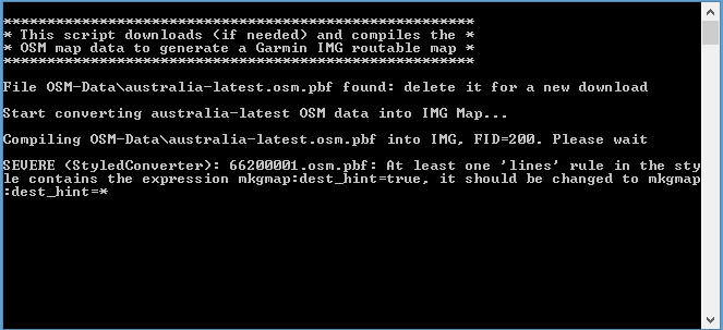
useing the new ignore bounds in splitter this happens Stephen <https://www.avast.com/sig-email?utm_medium=email&utm_source=link&utm_campaign=sig-email&utm_content=webmail> Virus-free. www.avast.com <https://www.avast.com/sig-email?utm_medium=email&utm_source=link&utm_campaign=sig-email&utm_content=webmail> <#DDB4FAA8-2DD7-40BB-A1B8-4E2AA1F9FDF2>

Hi Stephen, this is neither related to splitter nor to r3656 of mkgmap Please read the log messages for the latest changes <http://www.mkgmap.org.uk/websvn/revision.php?repname=mkgmap&rev=3675> http://www.mkgmap.org.uk/websvn/revision.php?repname=mkgmap&rev=3675 and http://www.mkgmap.org.uk/websvn/revision.php?repname=mkgmap&rev=3676<http://www.mkgmap.org.uk/websvn/revision.php?repname=mkgmap&rev=3675> <http://www.mkgmap.org.uk/websvn/revision.php?repname=mkgmap&rev=3675> <http://www.mkgmap.org.uk/websvn/revision.php?repname=mkgmap&rev=3675> Gerd ________________________________ Von: mkgmap-dev <mkgmap-dev-bounces@lists.mkgmap.org.uk> im Auftrag von Steve Sgalowski <steve.sgalowski@gmail.com> Gesendet: Montag, 4. April 2016 04:51 An: Development list for mkgmap Betreff: [mkgmap-dev] mkgmap.3656 program useing the new ignore bounds in splitter this happens Stephen [https://ipmcdn.avast.com/images/2016/icons/icon-envelope-open-tick-round-orange-v1.png]<https://www.avast.com/sig-email?utm_medium=email&utm_source=link&utm_campaign=sig-email&utm_content=webmail> Virus-free. www.avast.com<https://www.avast.com/sig-email?utm_medium=email&utm_source=link&utm_campaign=sig-email&utm_content=webmail>

Hi, I want to create a map for my 60csx by just using a very small subset of OSM data for aviation use. To do this I copy fragments from the default style to my own style (using single file aproach). This works well for the major roads, the rivers and water areas and the runways. However when using man_made=tower|man_made=mast|landmark=chimney [0x6411 resolution 24] I cannot change the resolution. Changing the number in the line above has no effect, neither in QLandkarte nor in my 60xsc. I want the towers to appear in a much more "zoomed-out" state. Any ideas why and how to overcome it? Thank you, Achim
Hi Achim, I assume that the change has an effect on the img file, means, mkgmap should produce a different output. You may check this with GPSMapEdit, it can show these details. If I got that right the Garmin devices have their own rules reg. the display of POIs, maybe it helps when you use a different type instead of 0x6411. I don't know much about QLandkarte, but I think it is open source, so you may get help there: http://www.qlandkarte.org/530747a0730821603/index.html If you cannot run GPSMapEdit, you may post a link to your style and the mkgmap options so that we can check what happens. Gerd ________________________________________ Von: mkgmap-dev <mkgmap-dev-bounces@lists.mkgmap.org.uk> im Auftrag von Achim Öhlenschläger <achim@webmail.mengelbach.de> Gesendet: Montag, 4. April 2016 09:44 An: Development list for mkgmap Betreff: [mkgmap-dev] Change resolution for towers in own style Hi, I want to create a map for my 60csx by just using a very small subset of OSM data for aviation use. To do this I copy fragments from the default style to my own style (using single file aproach). This works well for the major roads, the rivers and water areas and the runways. However when using man_made=tower|man_made=mast|landmark=chimney [0x6411 resolution 24] I cannot change the resolution. Changing the number in the line above has no effect, neither in QLandkarte nor in my 60xsc. I want the towers to appear in a much more "zoomed-out" state. Any ideas why and how to overcome it? Thank you, Achim _______________________________________________ mkgmap-dev mailing list mkgmap-dev@lists.mkgmap.org.uk http://www.mkgmap.org.uk/mailman/listinfo/mkgmap-dev

Hi Achim,
in my 60xsc. I want the towers to appear in a much more "zoomed-out" state.
60CSx has own settings for POI visibility, you set the map scale up to which POI are visible. If you set it to "Auto", then POI disappear quit quickly, when zooming out. I have found similar setting in Qlandcarte, but this is not a program I know, so you have to figure yourself, how it works. -- Best regards, Andrzej

Hi Gerd and Andrzej, thanks for pointing that out, suddenly all makes sense ;-) Now I'm facing the problem that there are far too many man_made=tower objects of which most are not useful for aviation. I need to learn more what additional tagging exists in OSM. Regards, Achim Am 04.04.2016 um 13:09 schrieb Andrzej Popowski:
Hi Achim,
in my 60xsc. I want the towers to appear in a much more "zoomed-out" state.
60CSx has own settings for POI visibility, you set the map scale up to which POI are visible. If you set it to "Auto", then POI disappear quit quickly, when zooming out.
I have found similar setting in Qlandcarte, but this is not a program I know, so you have to figure yourself, how it works.

Hi, I have this working for lighthouses with these line in my points file man_made=lighthouse | seamark=lighthouse [0x1151d resolution 17] (of course a different type code) As GPS I use an etrex 30 which has an advanced map setup where detail is set to most. In QLandkarte Setup->General->Preferences->Environment->Vector Maps the zoom level threshold for POIs should set to 500 and the zoom level threshold for POI labels should set to 600. (Einstellungen->Allgemeine Einstellungen->Einstellungen->Umgebung->Vektokarten: Zoomschwelle für POIs auf 500, Zoomschwelle für POI Label auf 600) Lutz Mändle Internet: lmaendle@gmx.net Berlin/Germany
Hi Lutz, mkgmap has some nice support for true marine objects on map, see: http://www.mkgmap.org.uk/websvn/filedetails.php?repname=mkgmap&path=%2Ftrunk... -- Best regards, Andrzej
Hi Lutz, thanks for this hint, this helps. Achim Am 04.04.2016 um 22:20 schrieb Lutz Mändle:
Hi,
I have this working for lighthouses with these line in my points file
man_made=lighthouse | seamark=lighthouse [0x1151d resolution 17] (of course a different type code)
As GPS I use an etrex 30 which has an advanced map setup where detail is set to most.
In QLandkarte Setup->General->Preferences->Environment->Vector Maps the zoom level threshold for POIs should set to 500 and the zoom level threshold for POI labels should set to 600. (Einstellungen->Allgemeine Einstellungen->Einstellungen->Umgebung->Vektokarten: Zoomschwelle für POIs auf 500, Zoomschwelle für POI Label auf 600)
Lutz Mändle Internet: lmaendle@gmx.net Berlin/Germany
_______________________________________________ mkgmap-dev mailing list mkgmap-dev@lists.mkgmap.org.uk http://www.mkgmap.org.uk/mailman/listinfo/mkgmap-dev
participants (6)
-
 Achim Öhlenschläger
 -
 Achim Öhlenschläger
 -
 Andrzej Popowski
 -
 Gerd Petermann
 -
 Lutz Mändle
 -
 Steve Sgalowski