
Hi Ticker, Thank you very much for your interest. Because I test pedestrian IS_IN another pedestrian I do not want to accidentally test the way against itself So I first must be sure I test a way against a square and nothing else. So i set the jbmsquare if it is an area highway = pedestrian & (mkgmap:mp_created = true | is_closed() = true) {set jbmsquare = true} highway = pedestrian & jbmsquare != true & is_in(highway,pedestrian, any) = true [0x10d0c resolution 24 continue] I use continue because if the processed element would have been a square in stead of a street it should get a polygon fill color in the polygons file later on as well. I’m very pleased with the results sofar. Actually none of the red marked lines is completely within the area, they all go out somewhere. The green ‘dreifaltigkeitsplatz’ is even 95% outside the square but still be considered inside (which is correct from mkgmap point of view and the method ‘any’ ) So ‘only’ the blue marked viktualienmarkt-way is not considered inside where I think it is, just as the others. Kind regards, Joris [cid:image001.jpg@01D62D0B.81F92F90] -----Oorspronkelijk bericht----- Van: mkgmap-dev <mkgmap-dev-bounces@lists.mkgmap.org.uk> Namens Ticker Berkin Verzonden: maandag 18 mei 2020 10:20 Aan: Development list for mkgmap <mkgmap-dev@lists.mkgmap.org.uk> Onderwerp: Re: [mkgmap-dev] Explanation of the is_in function Hi Joris couple of questions: 1/ what is jbmsquare and how is it set 2/ what does the rule 'continue' into. It looks like the red lines that have gone are entirely within the pedestrian area, but the blue one isn't. Ticker On Mon, 2020-05-18 at 07:07 +0000, Joris Bo wrote:
Hi
When testing the IS_IN function I get very nice results ! Thank you
very much for this improvement.
Could somebody help me to explain why a certain pedestrian is not
catched by the rules?
Also not a big deal, I’m already happy wit the current results, it is
just for understanding.
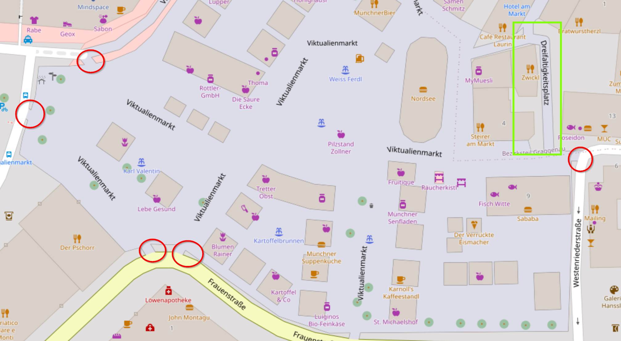
I am using pedestrian streets without an outline if crossing
pedestrian areas. 95% works perfectly but some seem to fool me.
Before
(The red lines are nicely replaced in the after situation, but the
blue one is not)
highway = pedestrian & jbmsquare != true & is_in(highway,pedestrian,
any) = true [0x10d0c resolution 24 continue]
area: München Viktualienmarkt:
pedestrian : https://www.openstreetmap.org/way/240014256
square: https://www.openstreetmap.org/relation/7431621#map=19/48.1351
2/11.57670
After
Met vriendelijke groet,
Joris Bo
jorisbo@hotmail.com<mailto:jorisbo@hotmail.com>
_______________________________________________
mkgmap-dev mailing list
mkgmap-dev@lists.mkgmap.org.uk<mailto:mkgmap-dev@lists.mkgmap.org.uk>
_______________________________________________ mkgmap-dev mailing list mkgmap-dev@lists.mkgmap.org.uk<mailto:mkgmap-dev@lists.mkgmap.org.uk> http://www.mkgmap.org.uk/mailman/listinfo/mkgmap-dev