
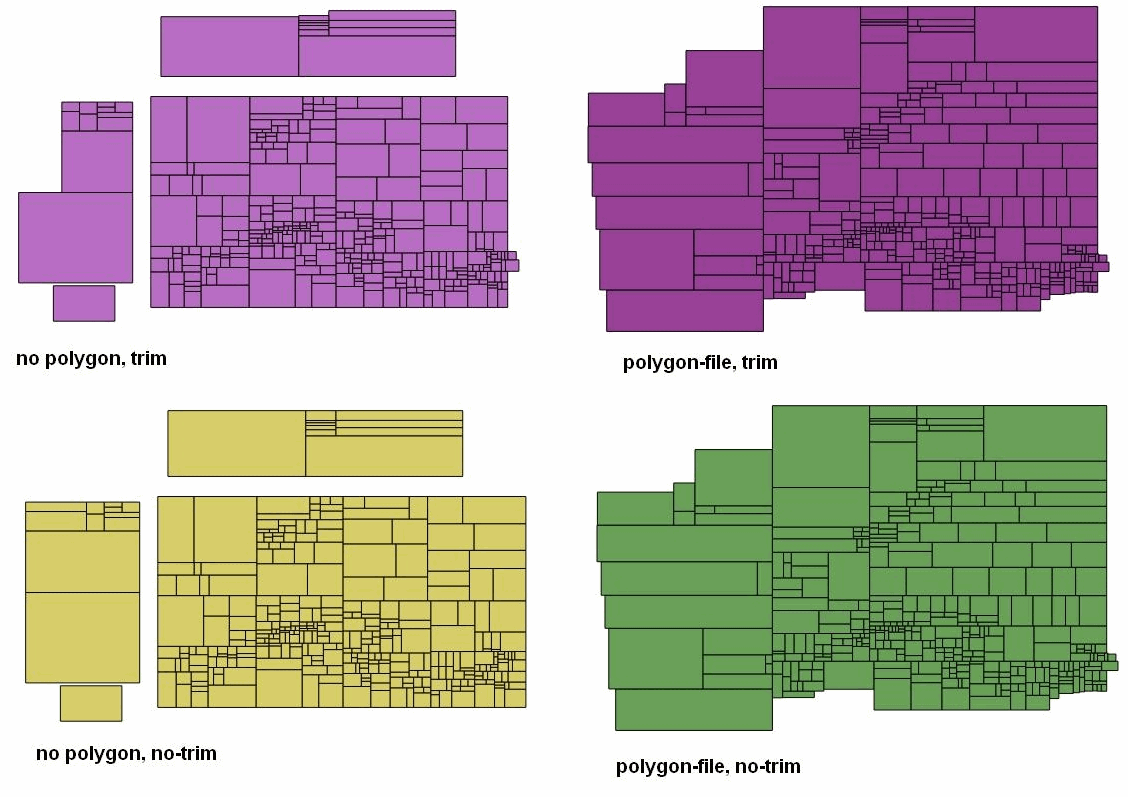
Hi, I'm trying to create contour map of Europe. I have created a rectangle area with contours using phyghtmap and then clipped it to europe.poly using osmosis. I'm working with splitter 421. My first split of data went wrong, some parts of north Scandinavia was missing. After some trying, I have found that adding option --polygon-file=europe.poly helps and map contains all data. But at the same time trimming of tiles stopped working and I'm getting some big empty tiles. I have attached a picture, showing all examples of splits. You can see, that without bounding polygon trim works but some data is missing. And with polygon trim doesn't work. My map will be transparent, without background polygon. I prefer to get tile area covering only existing data, which require trim to work. And I don't like empty tiles. I'm not sure what could help to debug this problem. Source data is about 1.3GB, I can upload it. -- Best regards, Andrzej