
11 Aug
2009
11 Aug
'09
3:45 p.m.
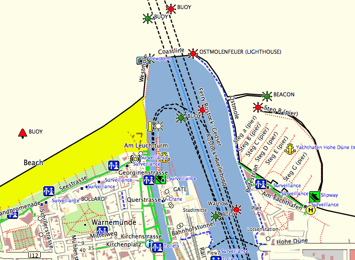
Hello (Ahoy?), The attached patch is inspired by the current OSM image of the week: http://wiki.openstreetmap.org/wiki/Image:Seamap.png The patch, which consists of style additions, adds POIs for marine navigation (buoys, lighthouses, etc.), as well as a line type for piers. You can see the results in the attached screen shot. The POIs are incomplete, and are my best estimation for the corresponding Garmin types. Piers are added as "footways" (which may also not necessarily be correct). Despite all the flaws, this may amuse you. ;-) Cheers.