
27 Jan
2020
27 Jan
'20
12:43 a.m.
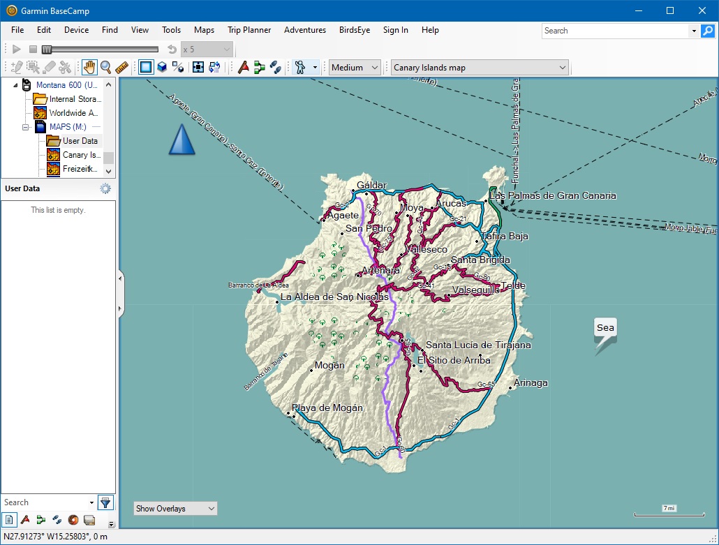
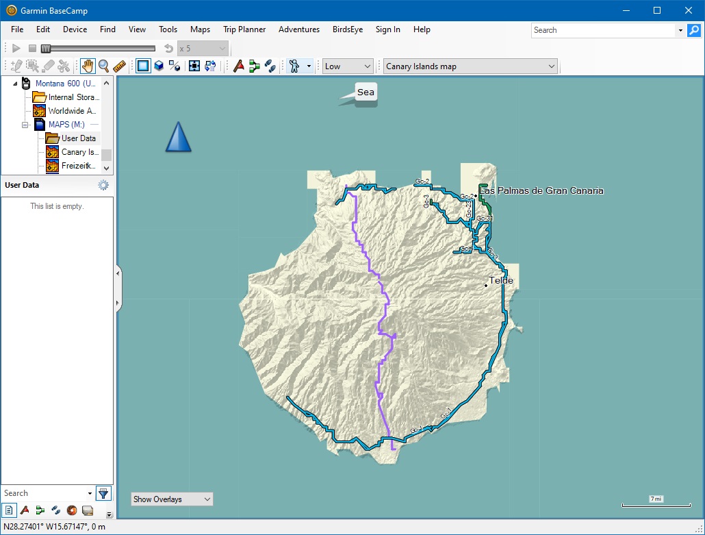
Hello, I am getting squaring off of the outline between land and sea at low zoom levels (less than 16) - see attached BaseCamp images of Gran Canaria at resolution 16 and at resolution 14 displayed at the same size. Obviously some reduction in accuracy is expected at lower zoom level, but not these artefacts. I'm not sure when this started happening but believe it was some time ago. I can't seem to find the old releases to try previous versions, http://svn.mkgmap.org.uk/mkgmap/releases/ just shows me an empty folder. Can you point me to the correct download folder that contains the previous jar files, and/or let me know if this is a known problem, and if so whether there is a workaround? Thanks, Mike