
18 Feb
2021
18 Feb
'21
12:03 a.m.
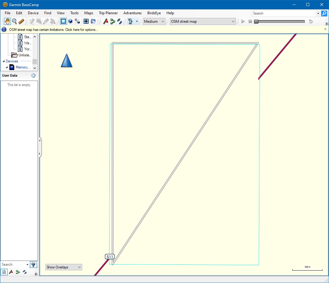
Hi all, In creating a small test file I seem to have found an issue. The attached OSM file has just 3 points and two ways form a right-angled triangle. In the attached BaseCamp image, the blue line is the boundary of the map. Its vertical lines contain the ways, but the horizontal lines do not. I can also see that the road in the underlying base map enters into the blue rectangle, suggesting that the blue line is not where the map boundary actually is. How does this boundary line get created Cheers, Mike