
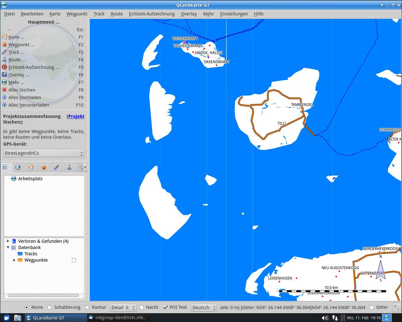
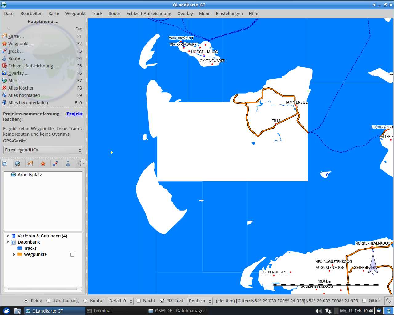
Hi, attached are two screenshots mkgmap-r4281.png and mkgmap-r2459.png. In the first there you can see missing sea. Map is created with splitter-r283 (max-nodes=1200000). mkgmap is called with these parameters: java -ea -Xmx2024M -jar /home/jolatt/OSM-Karte/mkgmap/mkgmap.jar \ --description=OSM_DE \ --country-name=Deutschland --country-abbr=DE \ --name-tag-list="name:de,name,int_name" \ --style-file=/home/jolatt/OSM-Karte/style/ \ --coastlinefile=/home/jolatt/OSM-Karte/coastline_germany.osm \ --generate-sea=extend-sea-sectors,close-gaps=4000,floodblocker \ --family-id=3333 \ --series-name=OSM_Deutschland \ --area-name=Deutschland \ --overview-mapname=OSM_Deutschland \ --tdbfile \ --draw-priority=25 \ --code-page=1252 \ --ignore-maxspeeds \ --ignore-turn-restrictions \ --ignore-osm-bounds \ --add-pois-to-areas \ --add-pois-to-lines \ --max-jobs=2 \ -c template.args 3333.TYP Any hints? BTW, my knowledge using mkgmap isn't good. Thanks Josef