
Hi Diego, I had a very similar issue when I used the same procedure : Hgt2osm then mkvmerge, etc.. (see https://www.mkgmap.org.uk/pipermail/mkgmap-dev/2022q1/033808.html ) To solved the issue, I change all my procedure to have perfect contourlines, avoiding mainly to use mkvmerge. First :
From all hgt xxxxxx.hgt files I generate the corresponding xx.osm.gz files with Hgt2osm (to be adapted)
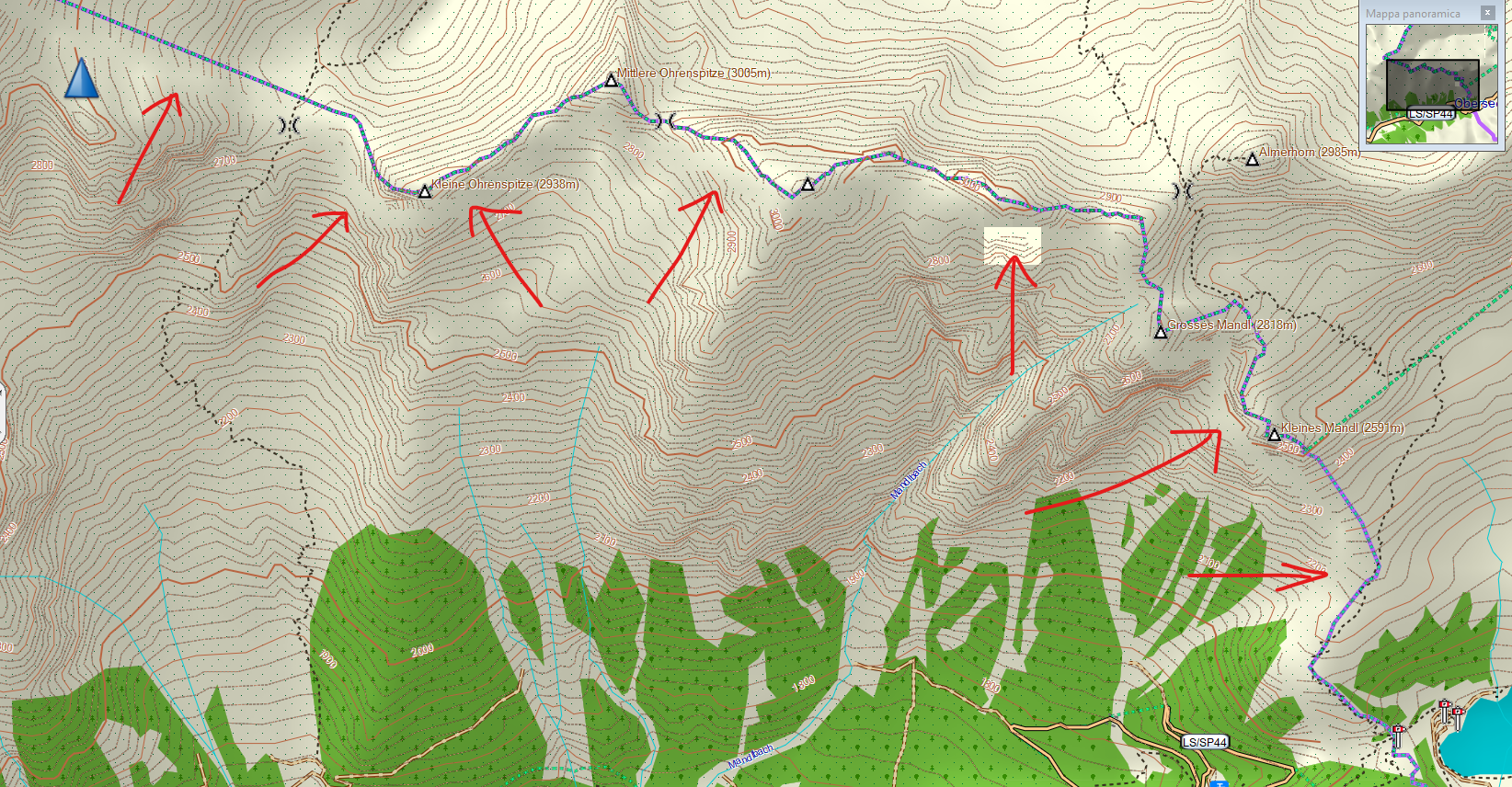
"hgt2osm -HgtPath=E:\Gps-Topo\00-Convers-MAN-Contours-Hgt-Osm\HGT-AFAIRE --MinBoundingbox=0.00016 --DouglasPeucker=0.12 --OutputOverwrite=false --MinorDistance=5 --MaxThreads=30" After 1) I splitt all xx.osm.gz with splitter(to be adapted) : CMD /K java -XmxNNNNNm -jar e:\Gps-Topo\splitter\splitter.jar --keep-complete=false --mapid=85000001 --max-nodes=2100000 --polygon-file=e:\Gps-Topo\00-Convers-MAN-Contours-Hgt-Osm\Contours-5m\limit es.poly --output-dir=e:\Gps-Topo\01-Contours-5m-Split\ e:\Gps-Topo\00-Convers-MAN-Contours-Hgt-Osm\Contours-5m\*.osm.gz 2) Then, I use mkgmap to produce contourlines (to be adapted) CMD /c Java -Xmx11000m -ea -jar e:\Gps-Topo\mkgmap\mkgmap.jar --latin1 --transparent --mapname=85000001 --show-profiles=0 --read-config=E:\Gps-Topo\HGT\listedem --dem-dists=5520 --dem-poly=e:\Gps-Topo\00-Convers-MAN-Contours-Hgt-Osm\Contours-5m\limites.p oly --style-file=e:\Gps-Topo\mkgmap\perso.zip --gmapsupp -c template.args *.pbf Best Regards, Gerard De : mkgmap-dev <mkgmap-dev-bounces@lists.mkgmap.org.uk> De la part de helter skelter Envoyé : jeudi 30 mars 2023 17:36 À : mkgmap-dev@lists.mkgmap.org.uk Objet : [mkgmap-dev] Problems with contours Hello guys I don't know if this is the right place to ask: please forgive me if not and delete my request. I have a problem with contours, generated from DEM HGT files, downloaded both from Nasa and Viewfinder, and tried with different Douglas-Peucker values. I get empty spaces in some areas of the map, close to the state/region border, and squares with no DEM data, as you can see in this picture (this is the north part of Trentino Alto Adige, north of Italy): I use HGT2OSM and OSMCONVERT to process all HGTs and obtain a single OSM file, the I split it with the Splitter. Then I merge everything in a single IMG file with MKGMAP. Do you know what could be the reason of this problem and how to solve ? Thank you in advance for all your help Regards, Diego