
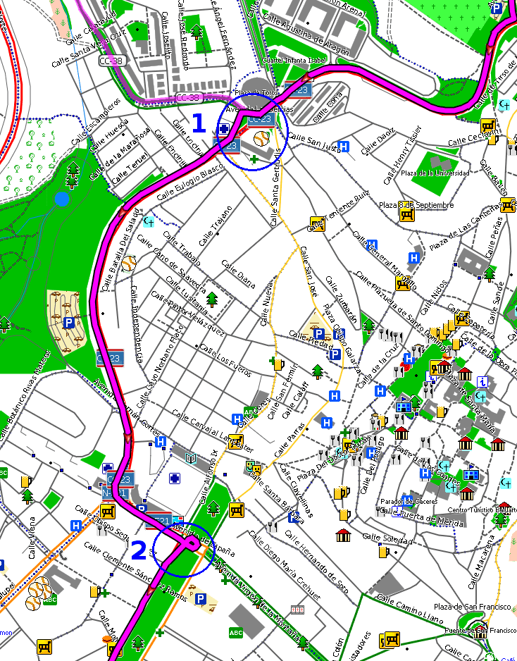
Current default style produces some estrange detours for a test route in a couple of places in my home town (blue circles 1 and 2 in attached screenshot). I've tracked the issue down and behavior has been changing with mkgmap versions, as detailed in the following chart, being current situation worst for this particular case: MapSource 6.16.3 BaseCamp 4.2.5 mkgmap version Car Truck Car Truck 1 2 1 2 1 2 1 2 <3081 OK OK OK OK OK OK OK OK 3088-3108 Suboptimal route OK Loop OK Loop OK Loop
=3111 Suboptimal route Bad Loop OK Loop OK Loop
Main changes were introduced with r3081 (merge from the high-prec-coord branch) and r3111 (merge from NOD127 branch). Perhaps those changes need a review. All test were done with the following command, only changing mkgmap jar file: java -Xmx600m -ea -jar mkgmap.jar --bounds=bounds.zip --route --latin1 --code-page=1252 --family-name="Test" --family-id=190 --product-id=1 --series-name="Test-default" --overview-mapname=55190000 --mapname=55190000 --index --add-pois-to-areas --link-pois-to-ways --location-autofill=is_in,nearest --style=default typ/EUR-190.TYP /home/carlos/tmp/test1.osm Files for test: http://alternativaslibres.org/files/detours.zip Note that first street after point 1 is tagged hgv=no, otherwise trucks would probably take the same suboptimal route than cars since r3081.