
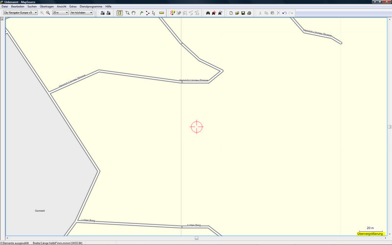
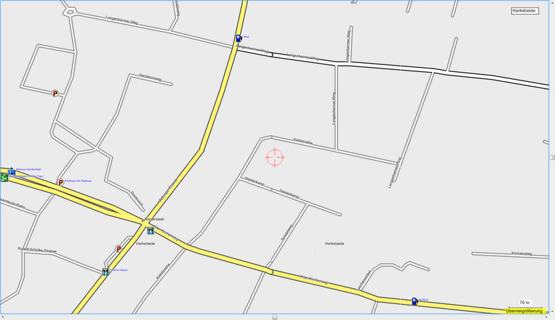
Hi, i'm using all stable splitter and mkgmap versions in tha last weeks, but also the latest splitter r78 and mkgmap r1160 versions, where i recognize on my oregon 300, that inter tile routing does not work and breaks with the german error message 'Routenberechungsfehler'. There is no difference in the routing result, by loading the generated gmapsupp.img from mkgmap or by loading the tiles via mapsource to the garmin device. Now i've done a look into mapsource and found on the original garmin city navigator v9 cards, that there are special 'rounded' line ends near the cut lines (see attachments). Is this a sign for a special garmin cut and merge function for the cards that is still missing in mkgmap or is it something else? I really don't understand the building of garmin image maps, but i can envisage the necessity of a merging point at a cut position. I calculate the german map from www.geofabrik.de: http://download.geofabrik.de/osm/europe/germany.osm.bz2 unzip the file and do the following: java -Xmx5000M -jar splitter.jar --mapid=63000005 --max-nodes=1000000 ../../germany.osm java -Xmx5000M -jar /osm/mkgmap/mkgmap.jar --style-file=/osm/styles --description='OSM by mb' --country-name=germany --country-abbr=DE --family-id=59 --product-id=112 --series-name=OSM --family-name=OSM --area-name=DE --latin1 --lower-case --mapname=63000005 --overview-mapname=63000001 --draw-priority=10 --add-pois-to-areas --net --route --gmapsupp --ignore-osm-bounds --location-autofill=2 --remove-short-arcs=9 --frig-roundabouts=0.1 ../*.osm.gz /osm/types/d310809.TYP Cheers Michael