
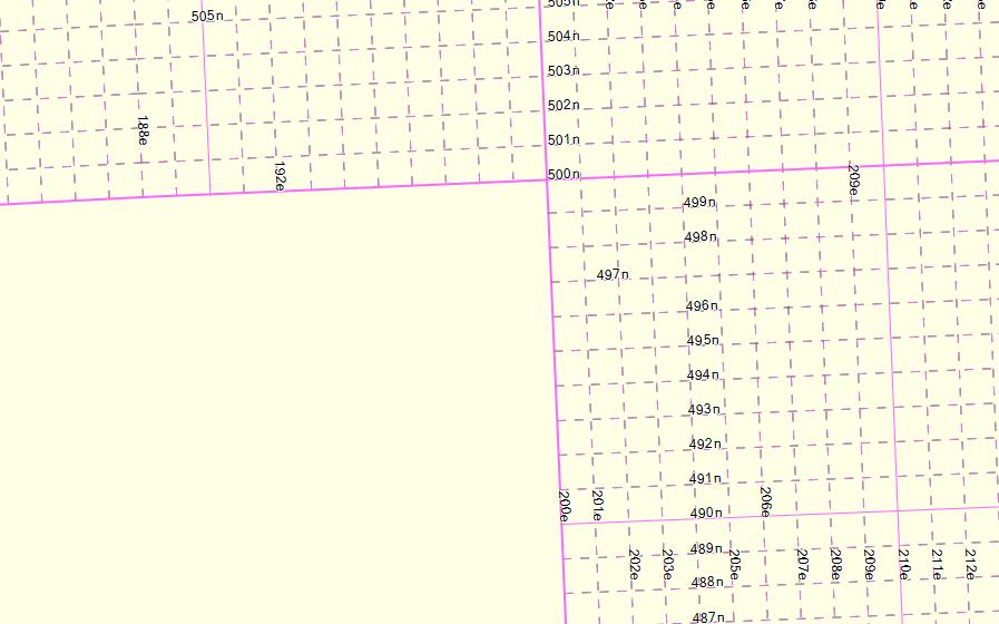
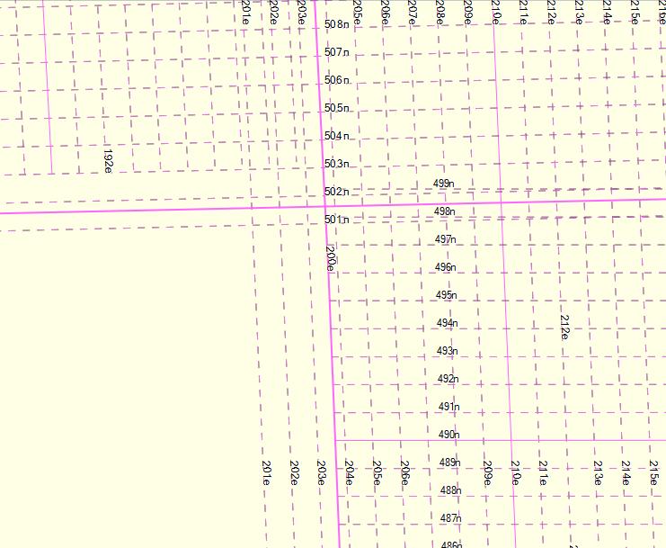
I have a file containing the British National Grid lines, as printed on Ordnance Survey maps. This can be found at http://www.rogercalvert.me.uk/osm/GBGrid/GBGrid.zip (this contains two files, they are the same except for the addition of the 'version' tag in the GBGrid06.osm file). I compile this file with mkgmap and overlay it on my GPS map. This works correctly with mkgmap 2654 and It displays correctly in JOSM. With mkgmap version 3241, the lines are misaligned and out of position. The behaviour is the same on MapSource, BaseCamp and my device. No error messages are produced. (I have not used any versions of mkgmap in between these two). My style file allocates codes in the 0x10300 range to these lines, but the effect is the same when I use code 0x21 (contour) for all lines. Attached are screen dumps for a small part of the map, from JOSM, mkgmap 2654 and mkgmap 3241, and also the batch file I used to compile it. I would greatly appreciate any advice. Many thanks, Roger -- ------------------------------------------------------------------------ Roger Calvert http://www.rogercalvert.me.uk ------------------------------------------------------------------------