
On Fri, Feb 20, 2009 at 3:58 AM, Ben Konrath <ben@bagu.org> wrote:
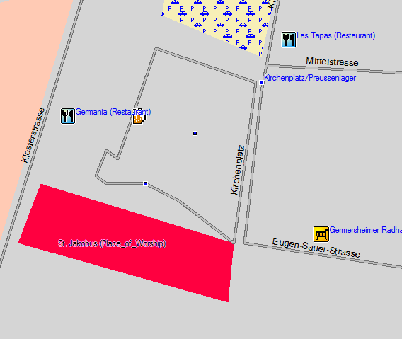
Currently the default style creates a residential road for plazas correctly marked with highway=pedestrian, area=yes.
A patch to correct this behaviour is attached. Comments are appreciated.
I manually applied this patch to my custom style files and recompiled my map. I have attached before and after screen shots of such a pedestrian area in Mapsource (the map is using the teddy.typ file from here: http://wiki.openstreetmap.org/index.php/User:Computerteddy). Pedestrian areas are now displayed as "City park" polygons (0x17). This is potentially somewhat confusing, as these pedestrian squares are generally completely paved, or may contain actual city parks. However I am not aware of any other Garmin polygon with an appropriate semantic meaning for this situation. I suppose city park is the best compromise. I'll most likely keep these definitions in my custom style files, but other users may have different opinions on the matter. Thanks for this: the rendering of pedestrian squares as residential roads has always bothered me. :-) Cheers.