
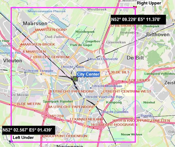
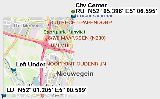
Hello, When using a poly file with a bbox for splitter on 'small areas' the resulting map is shifted / not complete. I assume it uses some rounding algoritm to redefine the coordinates specified. Could somebody explain me how to predict this behaviour. When starting from a center point : how many degrees should it minimum be extended to left, right, up and down ? Or maybe I do something wrong with the poly file. Kind regards Joris Here is an example where I specified a small bbox around a city centre. After supplying this to splitter in this case it only returns approximately the left/down quarter and the centre point is not included [cid:image001.jpg@01D49307.0FB4AC60] Supplied poly to splitter Splitter areas.polys result file JBM - Temp 1 5.01 52.02 5.01 52.09 5.11 52.09 5.11 52.02 5.01 52.02 (tested both with and without this line) END END Area 1 5.010002 52.020006 5.010002 52.090001 5.109994 52.090001 5.109994 52.020006 5.010002 52.020006 END END [cid:image002.jpg@01D49307.0FB4AC60]