
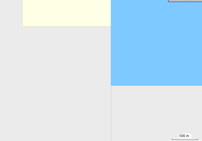
I started to make very basic checks to get the source of the tile bounds problems. I created the attached bbox1.osm and bbox2.osm. Both contain one rectangular polygon identical to the bounds. After compiling it with the default style I see in MapSource that the underlying land polygon (yellow) does not match to the data (blue) (see land_diff.png). Any ideas why this happens? Do you have any hints how I could proceed and where I should continue my investigations? Up to now I tried to decompile the img file with the Display project but failed on the RGN files (will need some time to investigate this). WanMil
I have attached an interesting screenshot from my Oregon 400t. The map is the All in one map Europe (http://wiki.openstreetmap.org/wiki/All_in_one_Garmin_Map).
You see that the light grey industrial area is splitted by a considerable yellow line. But the dark grey buildings do not have it although they are splitted by the tile bounds in the same manner. There is no multipolygon defined in the screenshots area.
Maybe the boundary clipper sometimes cuts too much?
I have never seen such artefacts on original garmin maps.
WanMil
I have checked the results of the AreaClipper and issued a warning in case one of the clipped polygons was not touching the clipped area. I found some but all of them were self intersecting polygons that were cut by the java Area class used by the AreaClipper.
So that's not the source of the problem. Any other idea?
WanMil