
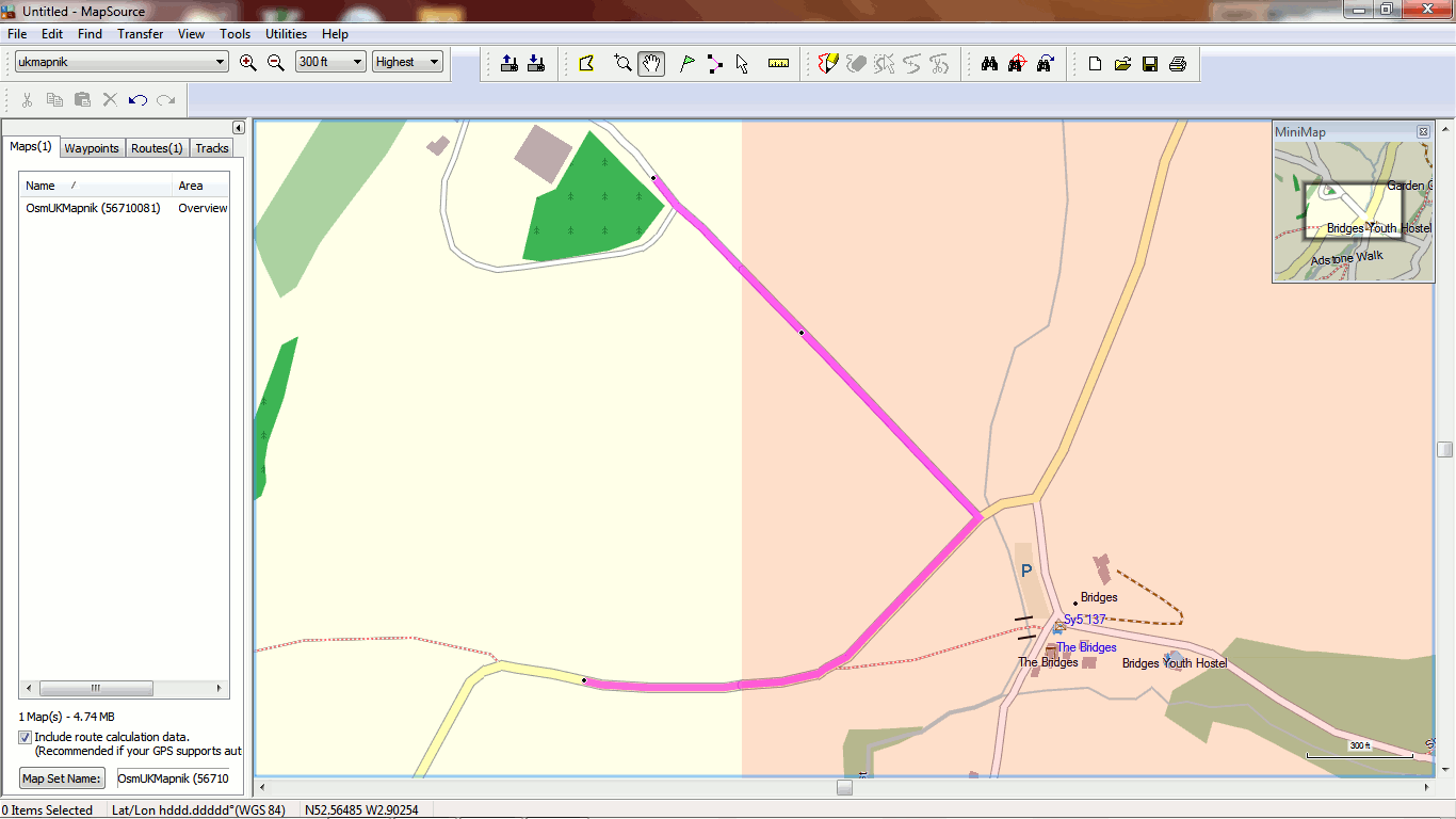
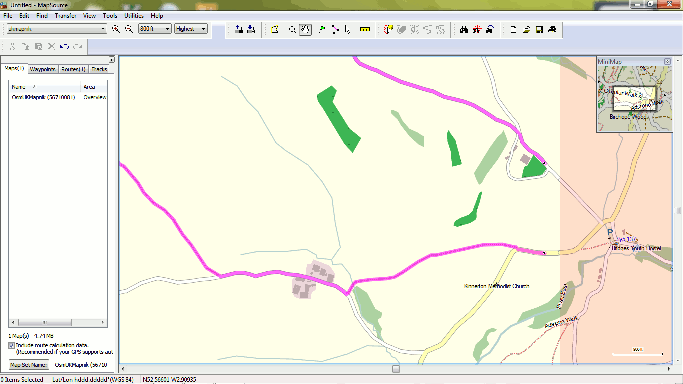
Hi, Steve, here are my settings for motorways: highway=motorway {add oneway=yes; add horse=no; add bicycle=no; add foot=no} highway=* & motorroad=yes {add oneway=yes; add horse=no; add bicycle=no; add foot=no} # set highway names to include the reference if there is one highway=motorway {name '${name} ${ref|highway-symbol:hbox}' | '${ref|highway-symbol:hbox}' | '${name}'} highway=* & motorroad=yes {name '${name} ${ref|highway-symbol:hbox}' | '${ref|highway-symbol:hbox}' | '${name}'} # convert links to generic ways highway=motorway_link {set highway=motorway} highway=motorway [0x10e0a level 3-7 continue] highway=motorway [0x10f01 level 2] highway=* & motorroad=yes [0x10e0b level 3-4 continue] highway=* & motorroad=yes [0x10f02 level 2] Minko, I'm not sure what you are asking, but I found a very broken route which should be <= 0.5 miles - see Mapsource screenshots attached. It seems you can "force" the correct route by adding an extra point just after the tile boundary. Geoff. -----Original Message----- From: Minko Sent: Sunday, August 04, 2013 9:06 AM To: Development list for mkgmap Subject: Re: [mkgmap-dev] Basecamp 4.2.2 Inter-tile routing problem Geoff, did you try it with shorter distance too? _______________________________________________ mkgmap-dev mailing list mkgmap-dev@lists.mkgmap.org.uk http://lists.mkgmap.org.uk/mailman/listinfo/mkgmap-dev