
15 May
2021
15 May
'21
7:34 p.m.
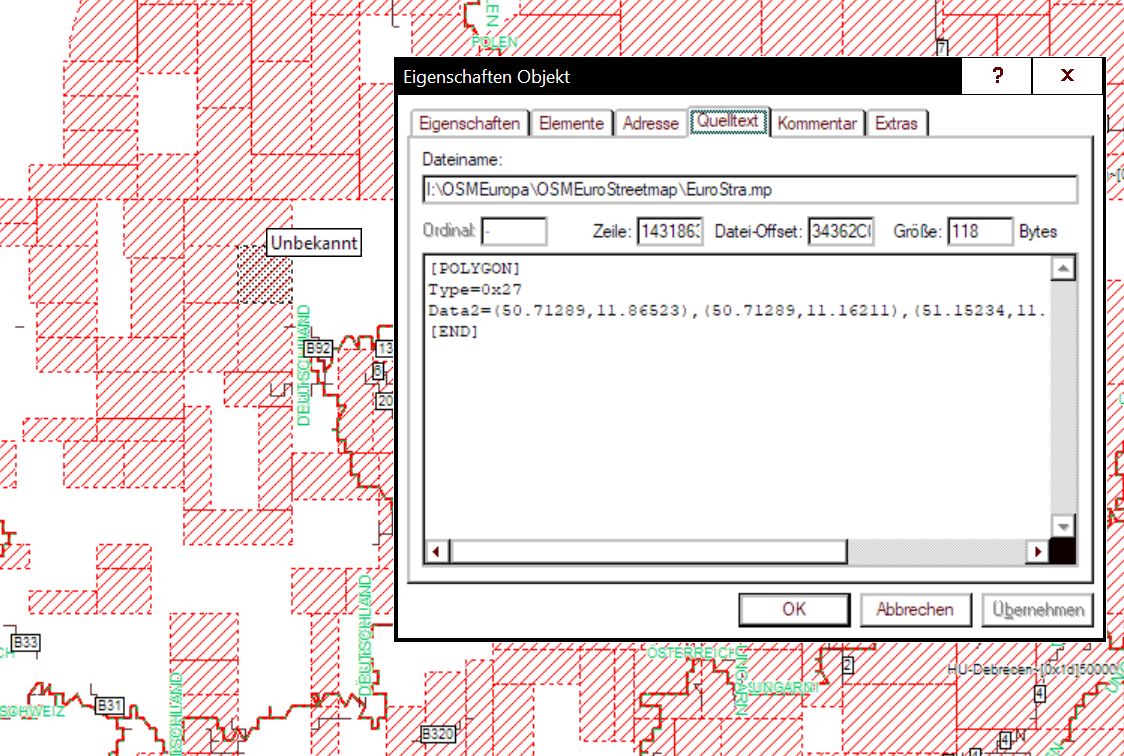
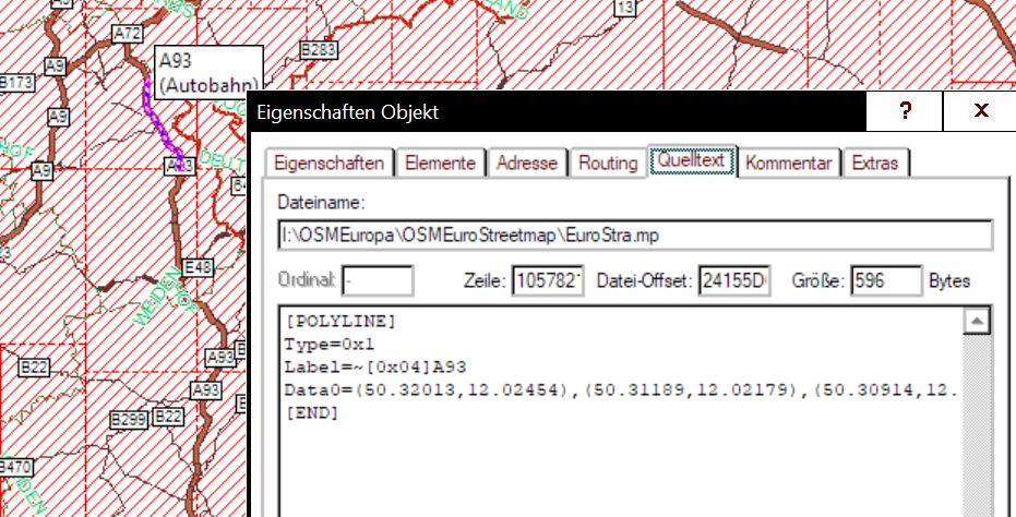
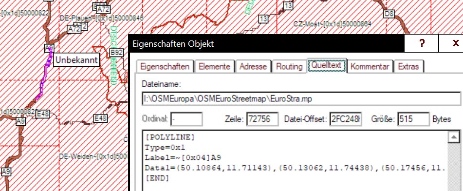
Hi, I noticed, that the linetyp highway=motorway is treated different in the overview map . For example the motorway A9 is Data1, motorway A73 is Data0 (I use GpsMapedit for analyse: polish map format). Polyline 0x01 : in Zoomlevel1 =6493 entrys, in Zoomlevel0=13676 entrys. Also polygon 0x27 : in Zoomlevel2=1519 entrys, in Zoomlevel0=20641 entrys. .Some entrys have Data2, others have Data0. Because that, when I zoom in or out, some motorways are displayed, others not displayed. I would expect, that same objects come to the same Level. I use my own STYLE. but is not very different from default. What can I do to avoid such inconsistence ? In my opinion, the same object should be completely contained at the same level. Thomas