
Hi WanMil,
So instead of using Garmins housenumber search you want to add a small road for each POI named with "${streetname} ${housenumber}'?
Yes. Only including house number in street name could be limited to cases, where it contains non-numeric characters. And there should be a possibility to add house number numeric value to this street as a number for indexing, not only as a part of the name.
* Wouldn't that blow up the index size?
Probably, but it should work. I have an transparent overlay with nearly 2.5 millions of address POI and index img for Mapsource is about 30MB. Quite manageable value.
* Must each invisible road be connected to the rest of the road network? Otherwise I expect that Garmin is not able to route to the housenumbered streets and we get thousands of routing islands?
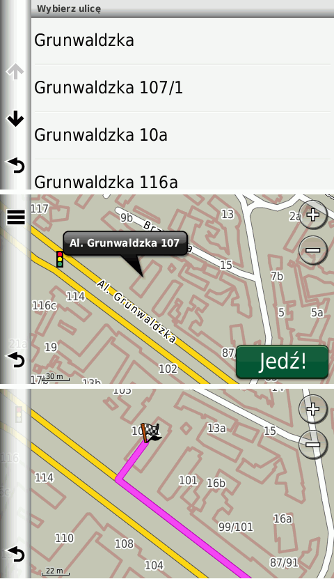
These roads don't have to be routable, only searchable. In my overlay I use roads type 0x13 with length of about 12m. Roads aren't connected to any network and whole overlay is not routable. GPS finds an address on non-routable road and then creates a route like to a POI, which is not placed on a road. See attached screen shoots from nuvi.
* mkgmap would have to modify/create a TYP file with one invisible road type. Should this be processed by mkgmap or is that a task of the map generator to ensure that the additional road type is invisible?
In my opinion mkgmap should provide generic tools and the rest should be left to map developer. -- Best regards, Andrzej