
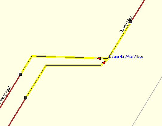
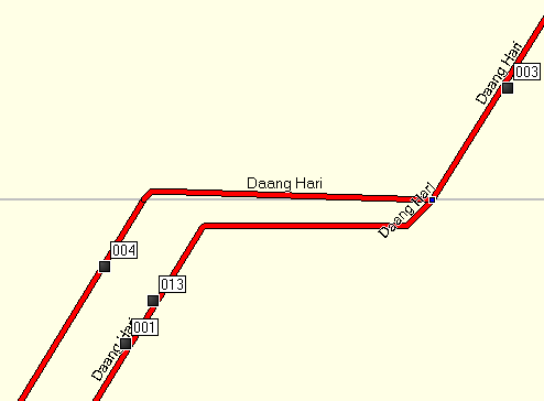
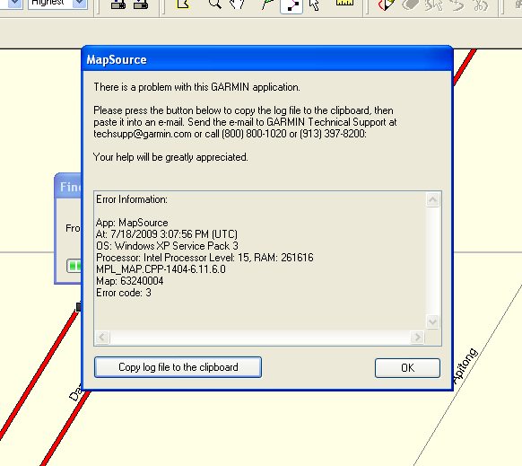
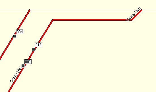
Using the same data without splitting routing is OK (Screenshot-2.png) Now trying with tiled data (screenshot-5.png), mapsource cannot route (screenshot-3.png). If I zoom a little bit closer the other tile disappears (screenshot-6.png). I can confirm this both in mapsource and roadtrip On Sat, Jul 18, 2009 at 2:27 PM, maning sambale<emmanuel.sambale@gmail.com> wrote:
It's exactly this node. I will post the bounds later
On Sat, Jul 18, 2009 at 2:21 PM, Mark Burton<markb@ordern.com> wrote:
Hi Maning,
The road intersection "Daang Hari" is exactly at the edge of my tile (made with splitter) routing does not work. But when I created another mapset without the splitter, routing works.
http://www.openstreetmap.org/?lat=14.413996&lon=121.01714&zoom=18&layers=B00...
Which part of this junction actually falls on the exact line of the edge? It can't be the whole junction, just some part of it.
Can you please post the XML bounds elements from the two tiles? It's near the top of the OSM file and looks like this example:
<bounds minlat='51.108398' minlon='-0.527344' maxlat='51.635742' maxlon='-0.131836'/>
Cheers,
Mark _______________________________________________ mkgmap-dev mailing list mkgmap-dev@lists.mkgmap.org.uk http://www.mkgmap.org.uk/mailman/listinfo/mkgmap-dev
-- cheers, maning ------------------------------------------------------ "Freedom is still the most radical idea of all" -N.Branden wiki: http://esambale.wikispaces.com/ blog: http://epsg4253.wordpress.com/ ------------------------------------------------------
-- cheers, maning ------------------------------------------------------ "Freedom is still the most radical idea of all" -N.Branden wiki: http://esambale.wikispaces.com/ blog: http://epsg4253.wordpress.com/ ------------------------------------------------------