
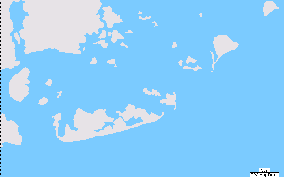
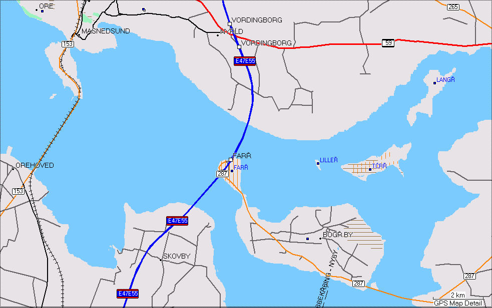
Firstly, I would like to thank everyone who responded to my "Understanding the sea" post. From those posts and my own study, I finally worked out what it does. And yes, it works pretty well inasmuch that it generates some useful polygons. The "sea sector" heuristic doesn't work for me so I have been disabling it. The problem is, the end result is "butt ugly". Our MP implementation really can't do a good job on zillions of little islands. After frigging around for a couple of days trying to improve the visual quality, I tried the obvious alternative technique of not using a MP but, instead, just having a sea background and then put the land on top using plain polygons. Guess what? It works very nicely as the attached pics show. I now have a splendid map of the Baltic area (OK it's weird at the edges but that's not a problem for now). Here's the (future) commit comment for this patch: Provide an alternative to using a multipolygon when generating the sea. The --generate-sea option can now take a comma separated list of values: no-mp - don't generate the sea using a multipolygon - instead, generate a background sea polygon and then individual land polygons with tag natural=land. This requires a suitable land polygon type to be defined in the style file (suggested type is 0x010100) and the polygon must be defined in the TYP file as having a higher drawing level than the sea polygon type. no-sea-sectors - disable the generation of "sea sectors" when the coastline fails to reach the tile's boundary. With no values specified, the --generate-sea option should work as before. Oh yes, this patch doesn't include it, but I am also disabling the DP code for polygons as it makes them weird. Cheers and thanks again for the helpful postings. Mark