
On 20.01.2010 11:12, Clinton Gladstone wrote:
2010/1/20 Felix Hartmann <extremecarver@googlemail.com <mailto:extremecarver@googlemail.com>>
Just downloaded new data for Germany, problem persists:
Is this maybe not solvable with current code? I'll retry with different max-nodes to see if it then maybe works.
I also noticed this with the Geofabrik extract of Germany: The tile around Bremen always gets flooded. My tiles are different from yours, so I assume we have different max-nodes parameters.
I did also compile Geofabrik's complete Europe extract: here the problem did not occur. There were a couple of other landlocked tiles in France and Poland which were flooded though (caused by, I assume, some bad data in the tiles).
This may mean, therefore, that the problem stems from the way Geofabrik extracts Germany. You could try making your own extract (using a bounding box) for Germany out of the Europe extract. Perhaps this would work better.
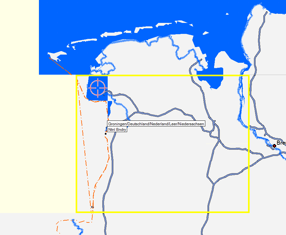
Cheers. -- I reduced maxnodes to 800.000 and then the flooding became a lot smaller (and not the whole tile anymore). The problem seems to be that there is sea in the North, then a section with land until the boarder, and then further south again sea. See below (or to the right) a screenshot of Garmin (Mapsource) Topo Deutschland v2. One can nicely see the problem of the country boundary going seperated through the sea. It is really strange that there is a sea section without exit on dutch territory. But well.
I don't know whether this can be fixable in code, or whether we should simply take it out from the main ocean and make a separate sea section in OSM data to make it easier to work with country extracts.