
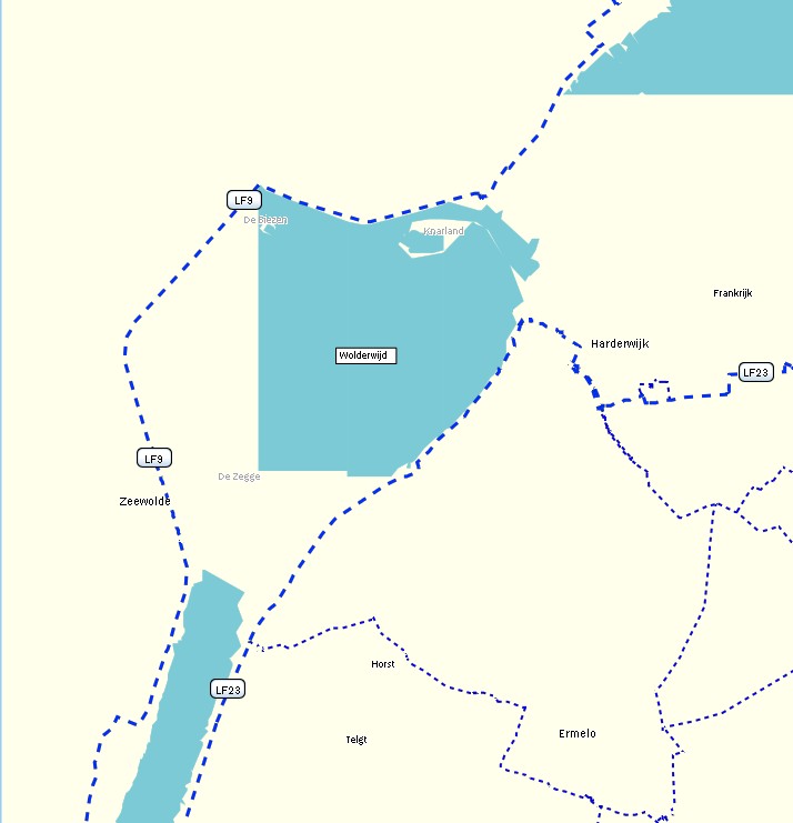
I'm experimenting a bit with the length() function in the polygons file, but the results are a bit unexpected. In my polygon style rule I have natural=water & length()>10000 [0x3e resolution 16] I would expect that mkgmap draws the whole relation of the Wolderwijd: http://www.openstreetmap.org/browse/relation/1204374 The total length of the relation is 33,79 km, see http://ra.osmsurround.org/analyzeRelation?relationId=1204374&_noCache=on The outer way is only one big way, http://www.openstreetmap.org/browse/way/80129565 But mkgmap draws only half of the lake, see length10km.jpg If I make natural=water & length()>5000 [0x3e resolution 16] it is a bit better, but still incomplete. Now this isnt a big issue, because I can use continue for higher zoomlevels, like natural=water & length()>10000 [0x3e resolution 16-17 continue] natural=water & length()>5000 [0x3e resolution 18-19 continue] etc Just wondering why the polygon isn't rendered completely (if I zoom in, the polygon is still the same edgy looking) Wanmil wrote:
It might be possible. The problem to be solved is that the garmin map geometry is not rectangular. So at the moment I don't know how the area size of a polygon can be calculated in a metric unit.
WanMil
Can something like the length function also be implemented for polygons to render big lakes earlier? For example natural=water & area() > 10 [0x3c resolution 16] natural=water [0x3c resolution 18]
(gmaptool shows this area in sq km)