
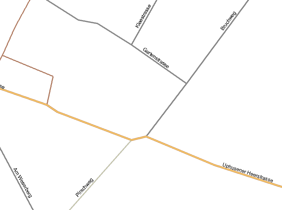
Moin, I have attached an OSM-file, where i have to effects with mkgmap-1562: 1. If I convert the OSM-file without any prior editing, the resulting map in mapsource is empty. If I remove the bounds section first, then I get the expected result. I don't know, wether the bounds are set incorrectly by JOSM (I created the OSM file by downloading and saving the data with JOSM), or whether mkgmap has a problem with such small bounds sections. 2. In the attached screen shot you can see the resulting map created by the attached OSM-file. If you zoom in very closely, there is a dent in the secondary road. If I open the OSM-file in JOSM, there is no such dent visible. Is this a data resolution problem of the Garmin format? In JOSM the intersection with the Pirschweg is more north than the intersection with the Bruchweg, in Mapsource it is inverse. Gruss Torsten